Keelung Geographic Information System
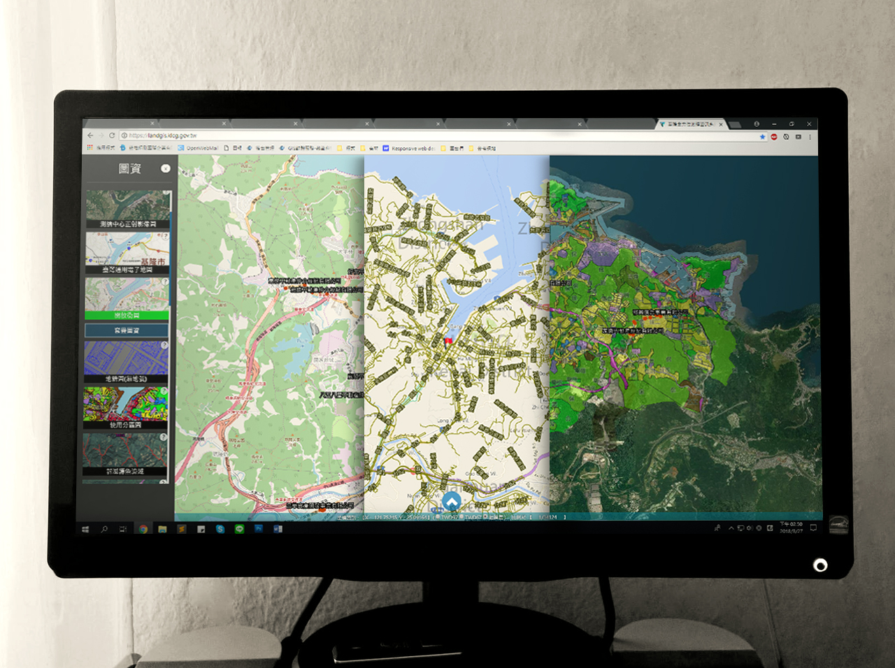

An all-in-one online GIS system capable of querying information and conducting business analysis and ecological surveys. The platform includes common features such as map location and area and distance measurement features, as well as search features for real estate information such as actual price registration. The platform can also be used to find out if there are any potential landslides or floodings nearby. Combined with streetscape facilities, the user can also search for information with house numbers and land serial numbers. Currently, 19 map overlays in 7 categories, such as land administration, zoning, and cadastre are available, which are all information that closely relates to the daily life of Keelung citizens. The ability to query real estate information, including actual price, market analysis and details on the livability of nearby areas with just the house number allows the platform to provide an accessible reference for those who are looking to move.
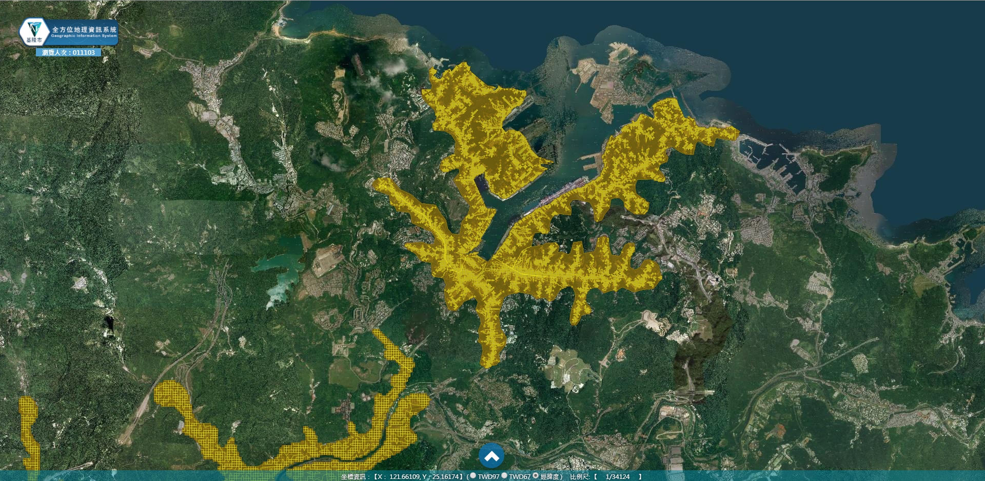
Flood Potential Map
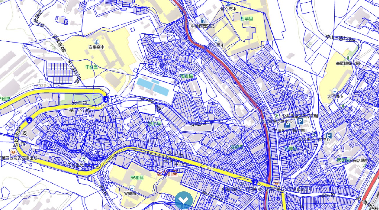
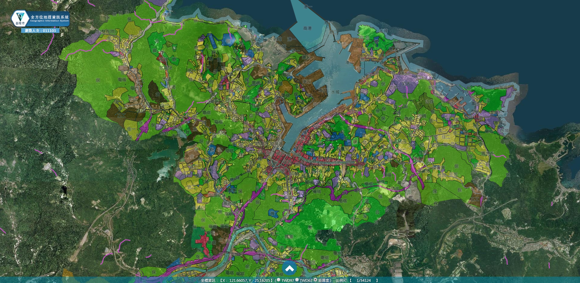
Cadastral Map
The platform provides a user-friendly interface created from the user's needs, including easy-to-use features such as:
1. Wide Variety of Overlay Map Data
With 19 overlay data over 7 categories, the system incorporates geographic information with the different facets of a citizen's day-to-day life.
2. Easy-to-Use User Interface
User Experience has always been the top priority in our products. As the platform will be accessible to the general public, we take on the great challenge to create a user interface that can be navigated by anyone. We achieve this by grouping components into categories and creating graphical buttons that are easy to understand. Detailed instructions are also provided for each feature to assist in the use of the platform.
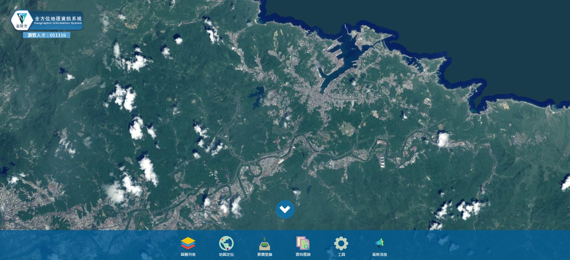
3. Large Selection of Map Features
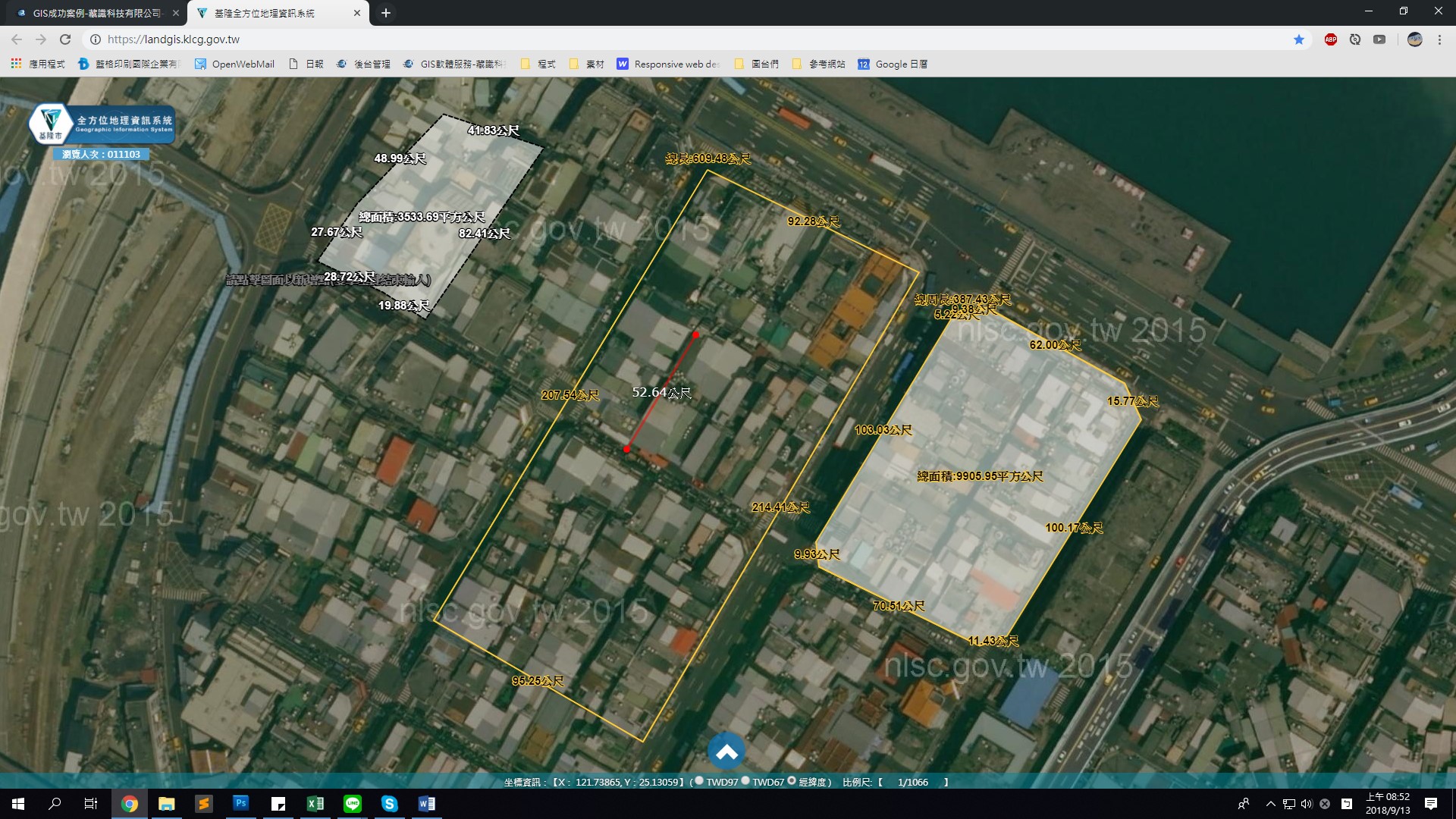
The platform is equipped with functions such as layer list, location, actual price registration search, toolbars, and news features. Providing services that range from ecological surveys to business analysis.
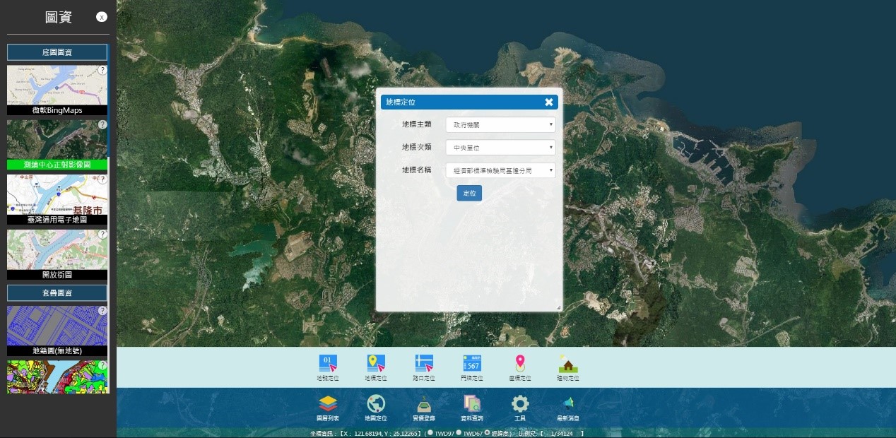
4. Useful Tools
The platform also includes tools that let the user mark, analyze, measure, query, and locate any point on the map. The system also integrates government information with citizen activities and geological data.