Military and National Defense Application
Simulating realistic missions with high-performance algorithms, allowing users to control existing national defense technologies, such as tanks, fighter jets, and ships on the country's only GIS-based battle simulation system.
Integrating technology from the military to our GIS platforms, allowing users to view radar or electronic-warfare information on the map in real-time.
1. Path Analysis
The system calculates the best aerial path to avoid radar detection for different types of fighters based on factors such as the detection range of existing radar technologies, the mechanical characteristics of the fighter (maximum climb rate, minimum turn radius, etc.), and man-made or natural terrain.

Path Analysis (Simulated)
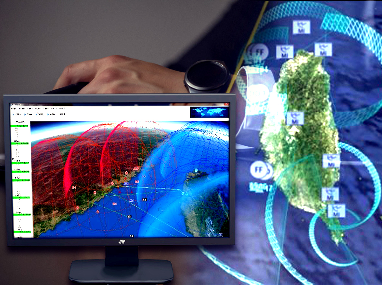
2. Maritime Radar
Besides path analysis for the Air Force, the system can also find existing blind spots by simulating enemy forces over existing fixed radars on land and mobile radars on ships, allowing users to plan out the best locations for radar and troop deployment.

Maritime Radar(Simulated)
3. Missile Flight Path Comparison
The system can compare the actual flight path of missiles with the estimated path and calculate error margins, providing an additional reference for design or fixes.

Missile Flight Path Comparison (Simulated)
4. Electronic Warfare
The system can visualize the mass amounts of moving data returned by electronic warfare stations on maps in real-time

Electronic Warfare (Simulated)
5. Field Strength Analysis
Natural terrain, such as mountains, can often limit the detection range of radars based in mountains or areas of high altitude. The system can analyze the signal strength in the radar's detection range by factoring in surrounding terrains and facilities

Field Strength Analysis(Simulated)
6. Mission Route Planning
After the user inputs the mission requirements and target location, the system calculates optimal mission paths for tanks that avoid obstacles such as structures and enemy facilities or troops, while including roads and bridges that can be passed based on the tanks' weight and dimensions.

Mission Route Planning(Simulated)