Application Development Platform for Disaster Management
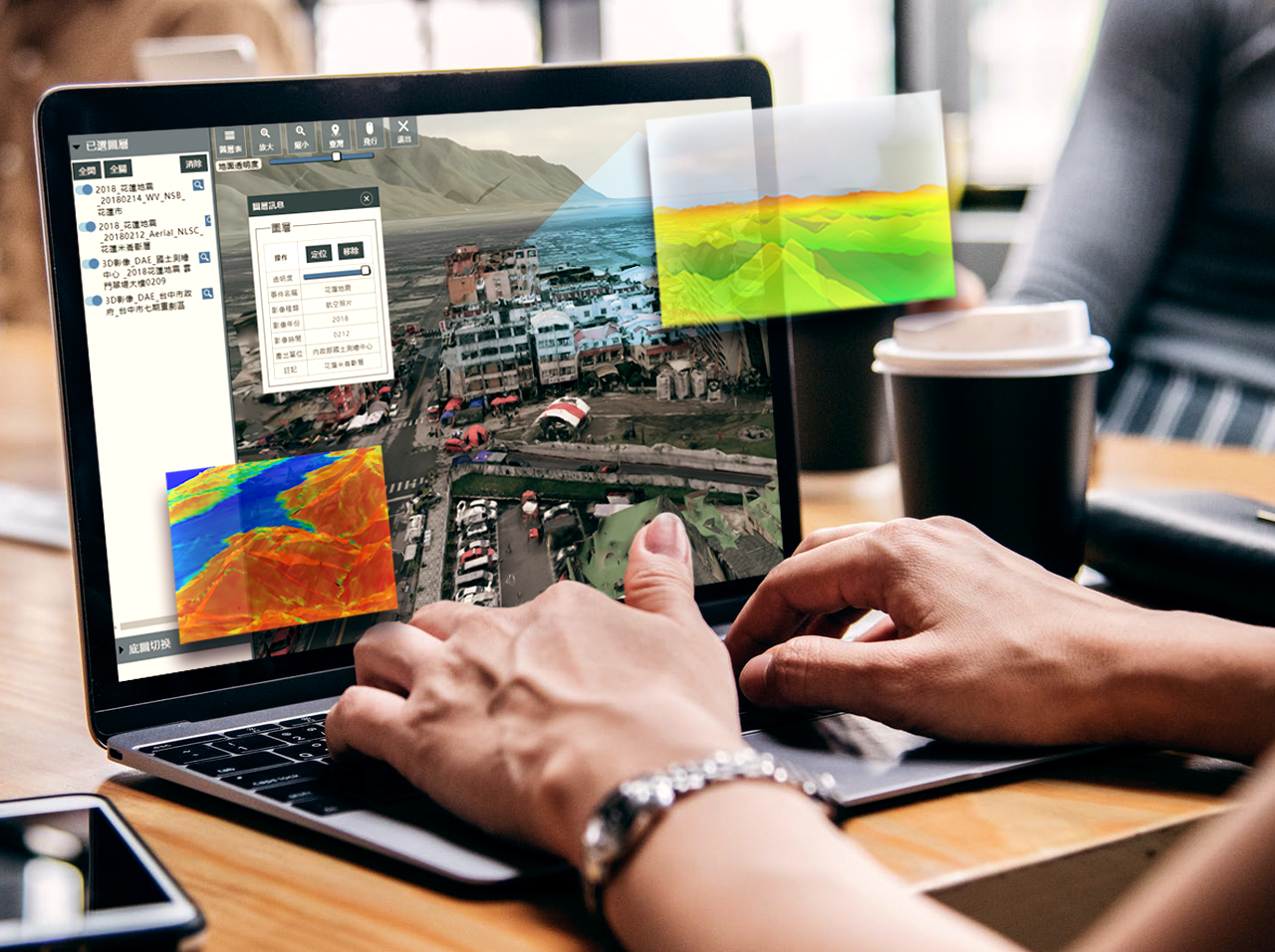

A national web service that provides comprehensive disaster analysis and simulation. With the ability to switch between 2D and 3D views of the terrain with complex image overlays and provide detailed analysis through different modules, the service provides a variety of applications across multiple levels. The service aims to combine data with applications, revitalize the horizontal integration mechanisms, enhance technology in disaster prevention and accelerate the sharing of huge amounts of data. The platform, jointly developed by Pilotgaea and the NSTC (National Science and Technology Council), combines our knowledge and decades of experience in GIS software development with the data and information provided by the council. Equipped with the ability to view landscape changes in the past years, the platform allows users to compare the surface changes of the landscape before and after disasters and the impact caused by major natural disasters, providing valuable information for decision-making and disaster prevention.
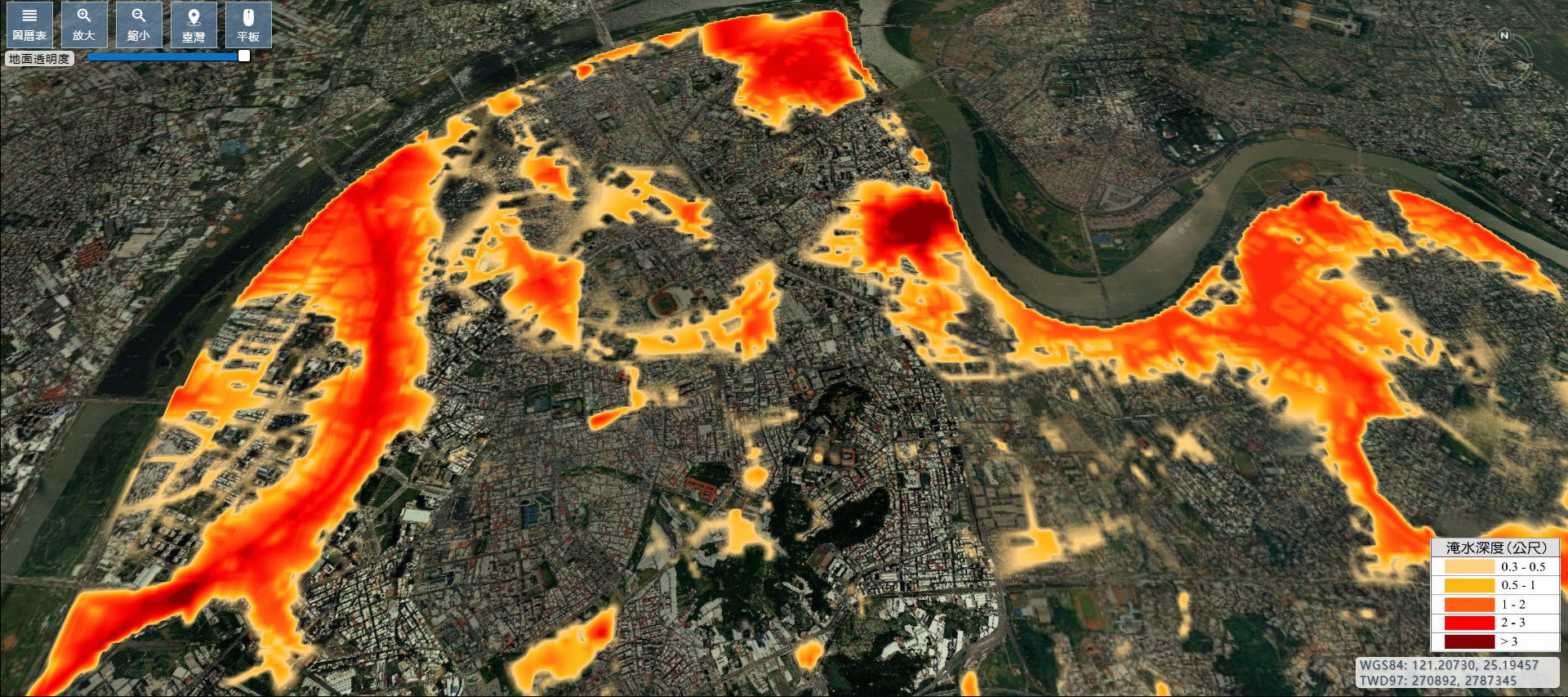
Flood Area Simulation
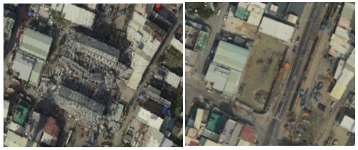
Before-After Comparison for the Demolition of the Collapsed Weiguan Jinlong Complex
The platform provides a variety of precise information in disaster relief and research. We at Pilotgaea invested considerable resources in developing system functions that serve as the base of the following features:
1. High-Precision Map Images
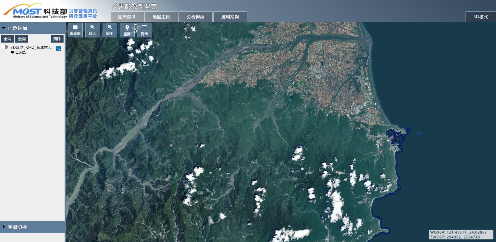
We produced ortho images without shadows, clouds, or seams by combining high-resolution satellite images from different camera angles over the years. The results are True Ortho images that satisfy the following specifications
(1). Seamless 2D true ortho image produced from multiple images
(2). Spatial resolution of 0.5 meters
(3). CE90 absolute accuracy of less than (including) 3 meters
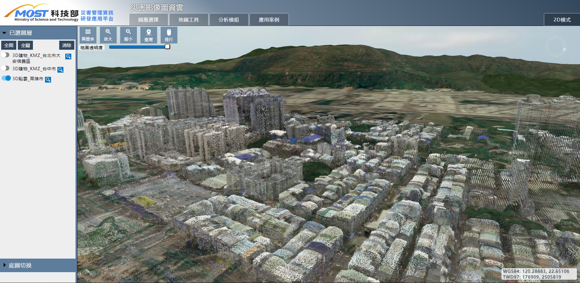
2. Realistic 3D View
The platform presents a realistic 3D View with WebGL through the combination of light and water physics simulation and 3D data that includes a large number of model sets and terrain information.
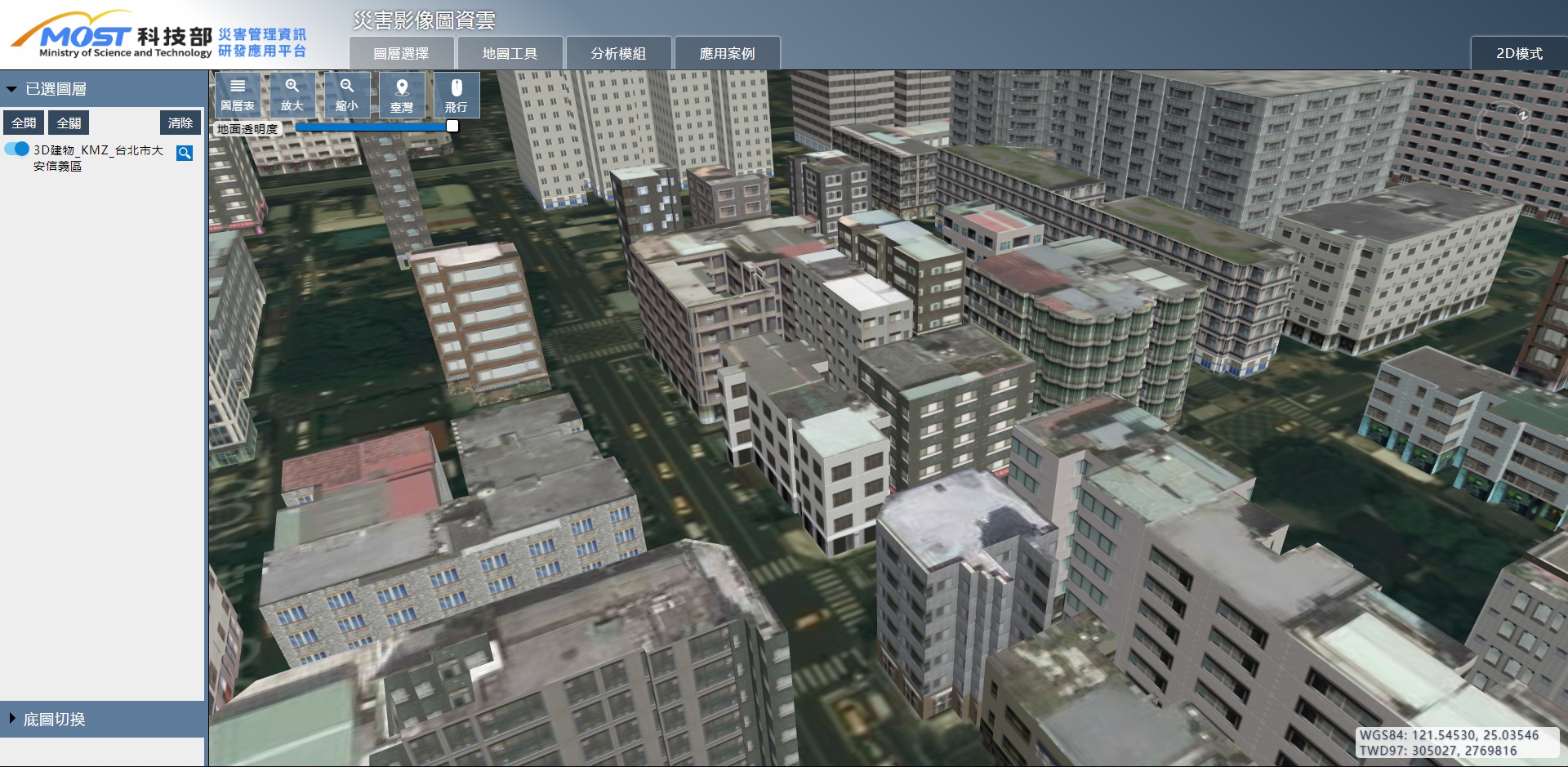
3. Handling Large Amounts of Data
The platform can display a large number of models, lidar data, and photogrammetry models at high definition without slowing down with the help of built-in algorithms.
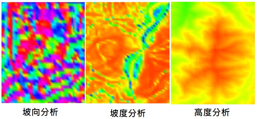
4. Support for Various Analytic Tools, Geometric Calculations, and Visualization of Time-relevant Data both Under and Above Ground