3D Underground Pipeline Management System
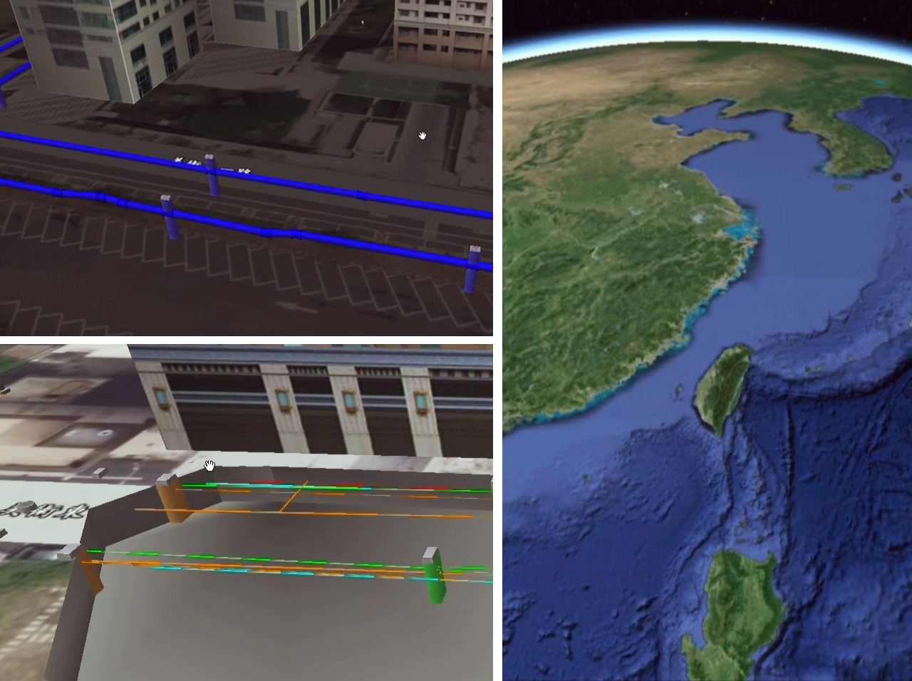
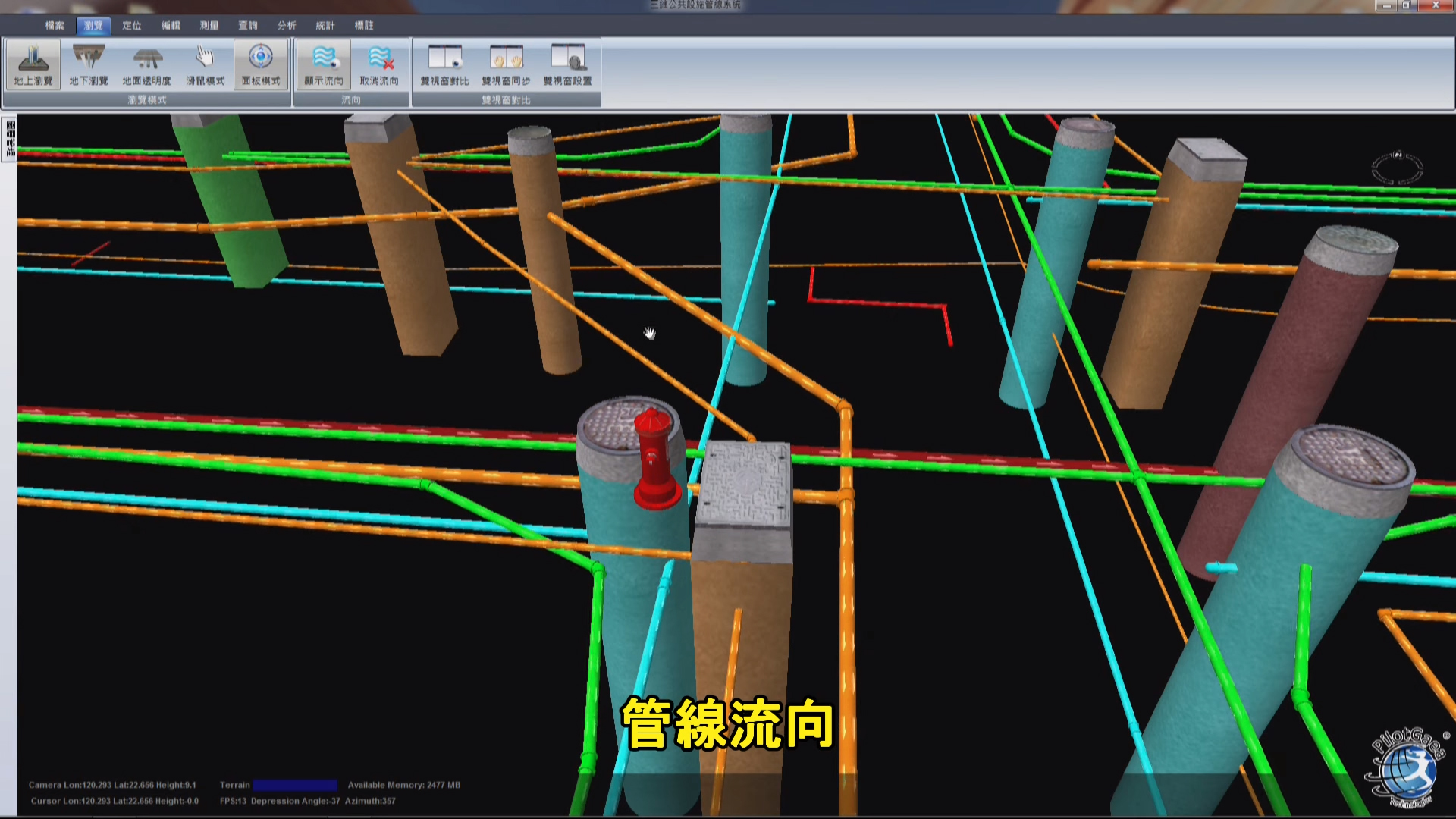
The system generates realistic 3D graphics in the view that displays different types of pipelines and automatically generates the location where they are buried underground. The system can also query for the pipelines' dimensional properties such as pipe diameter, buried depth, or pipe length. By combining 2D and 3D views, the system also allows the user to observe how the pipelines are laid out at construction sites at angles that would be impossible in real life.
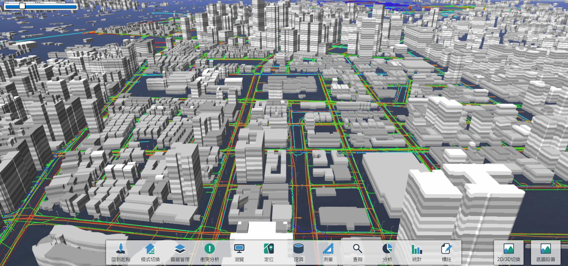
Screenshot from the system
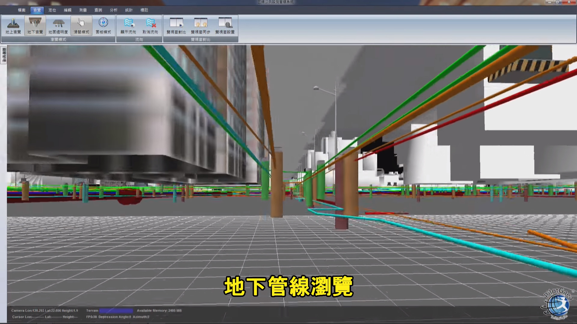
Underground pipeline view
Detailed system functions are as follows:
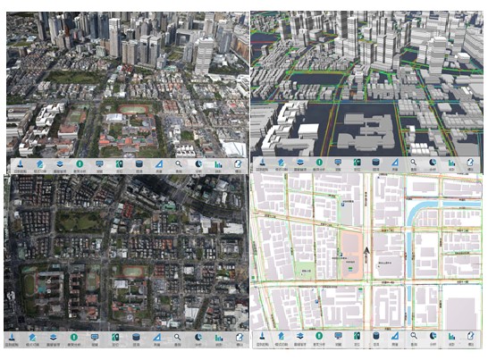
1. Various Viewing Modes
8 window layouts including 2 single window layouts, 4 dual window layouts, and 2 3-window layouts. This allows the user to view 2D/3D maps simultaneously or observe sites through Streetscape, 2D and 3D views in a 3-window layout
操作.jpg)
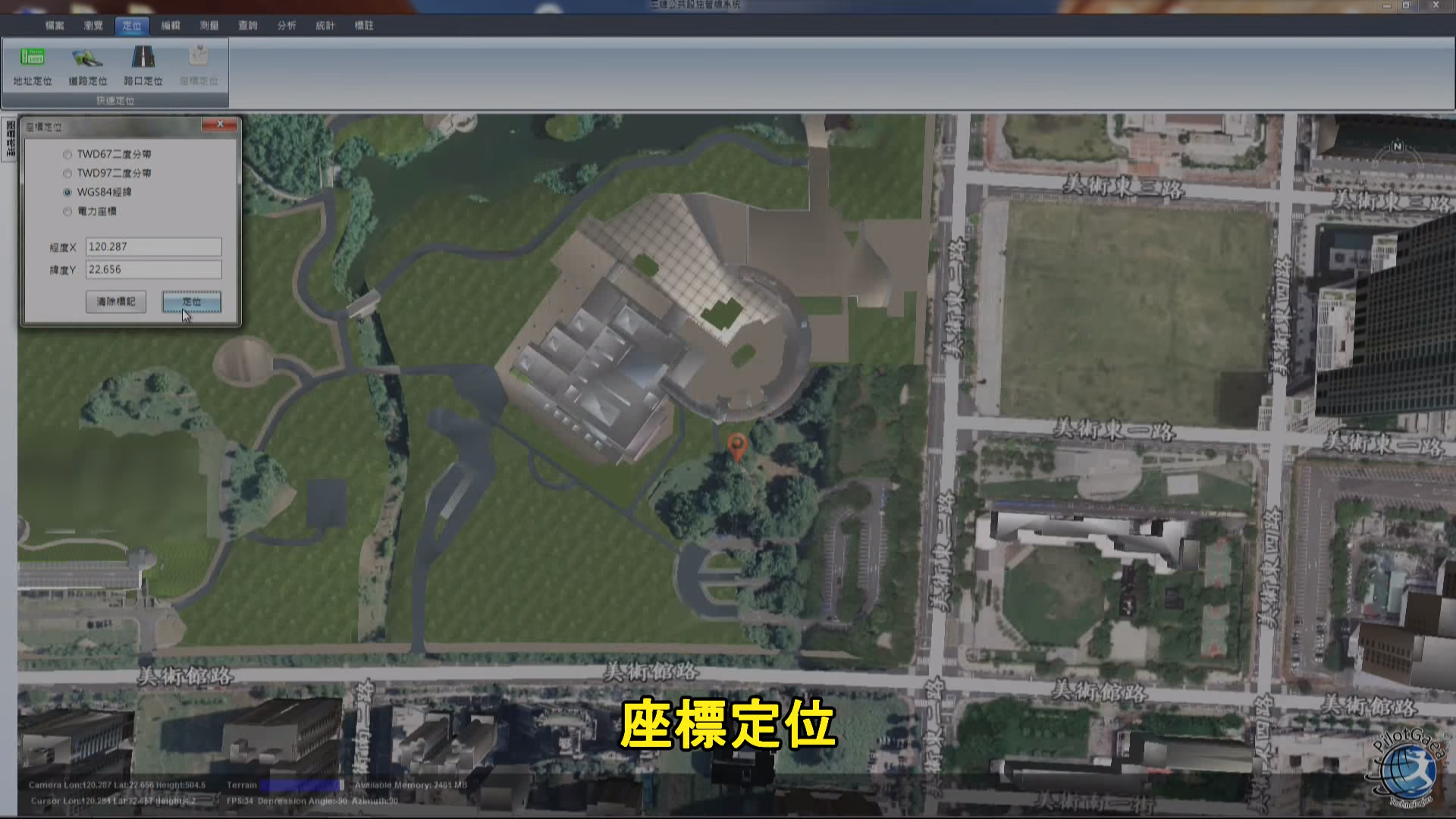
2. Coordinate Location Feature
The system can locate addresses, coordinates, landmarks, pipelines, and junctions. The user can select between 4 coordinate systems including TW D97 and TWD67 and 18 categories for landmark locations.
3. Multiple Measuring Features
The system can measure distance, area, and shortest pipeline distances.
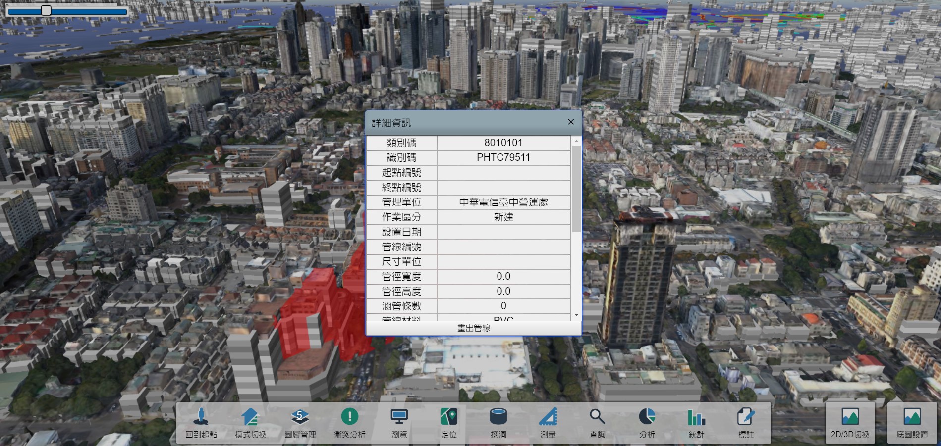
4. Complete Querying System
The system can query based on 5 categories: Space, Equipment, Pipe diameter, Material, and SQL
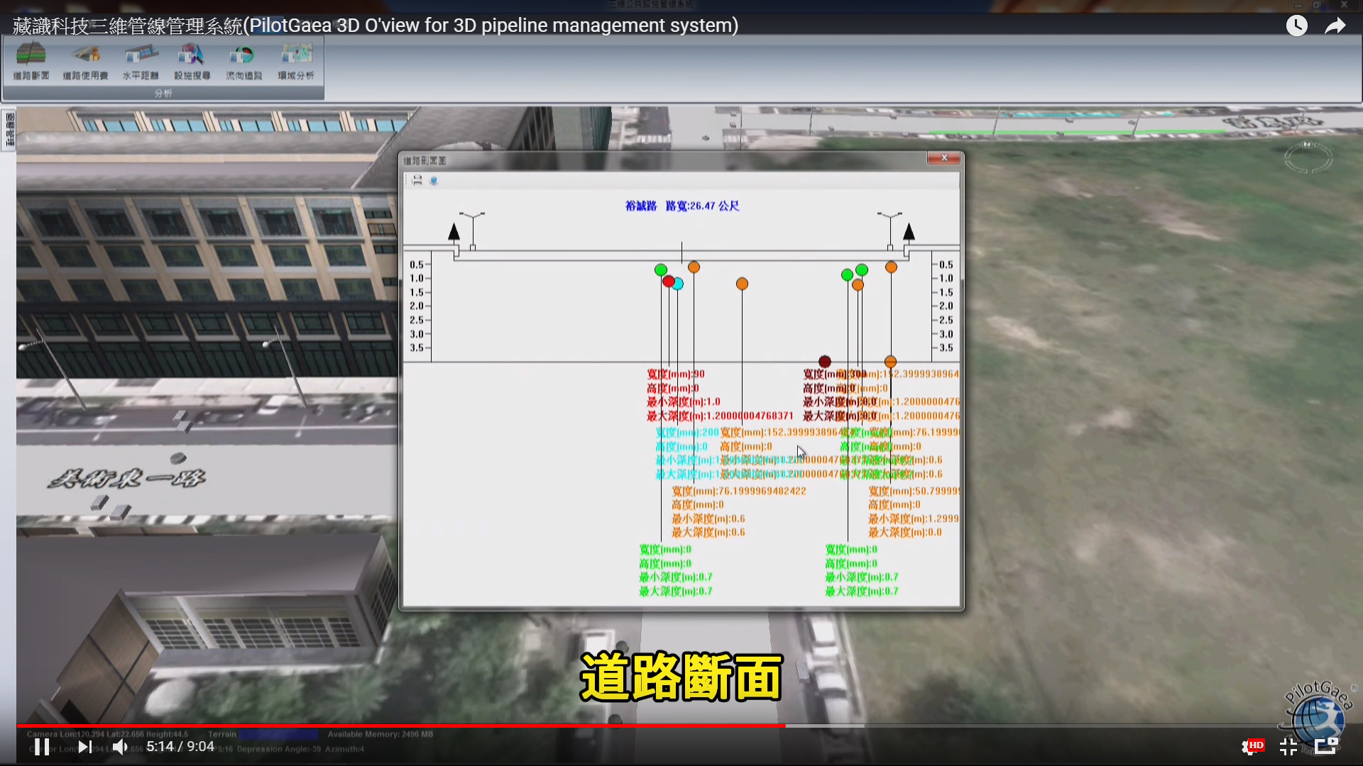
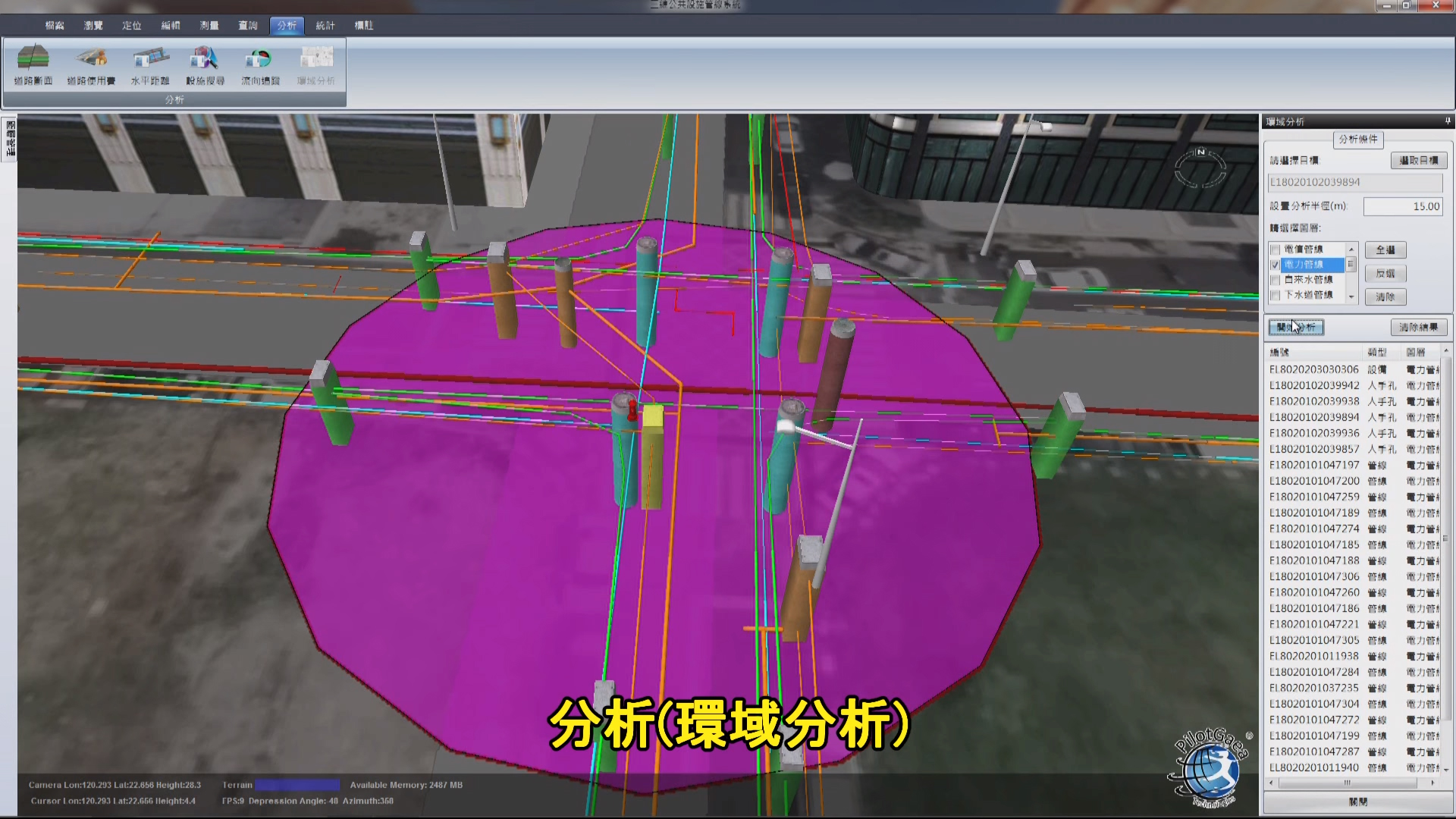
5. Complete Analysis Feature
The system can analyze road sections and horizontal distance. Buffer analysis and leak analysis can also be performed.
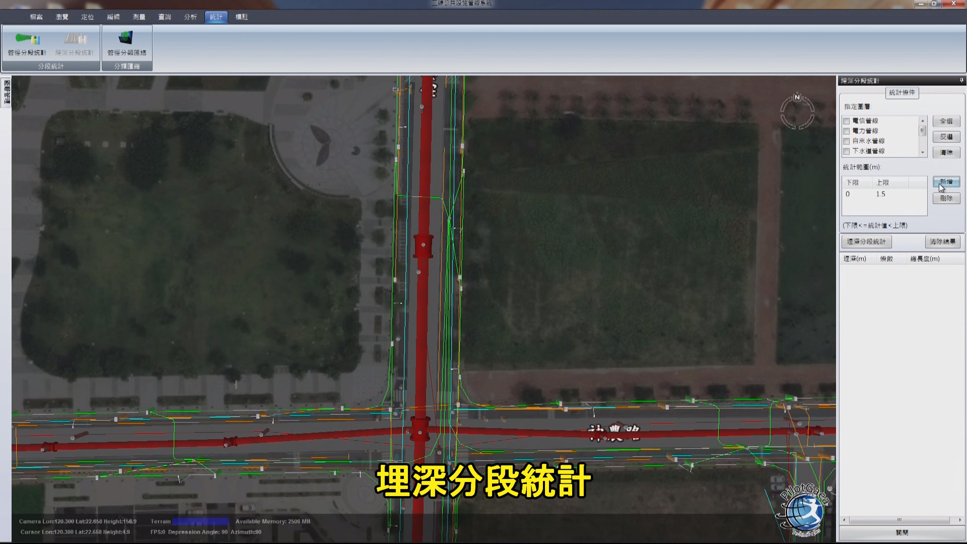
6. Full Statistical Features
The system can analyze statistics on categories such as pipe diameter, buried depth
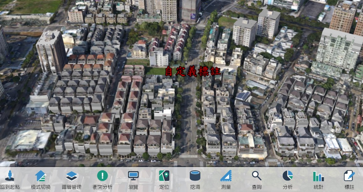
7. Detailed Marking Features
The system allows users to make custom markings for information such as height, pipe diameter, buried depth, coordinates, and distance of pipelines.
8. Multiple Modes
The system allows users to focus on observing the construction site with the city mode or conduct detailed planning with the pipeline mode.
9. Large Collection of Map Overlays
The system includes 15 layers over 3 categories such as pipeline and terrain, and 7 base map layers to choose from
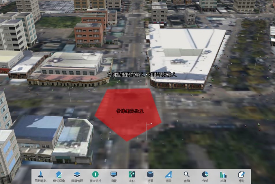
10. Conflict Analysis
The system comes with a unique conflict analysis feature that automatically displays conflicts from any combination of pipelines of any type. Analysis for a limited range can also be performed on user-defined areas or locations.
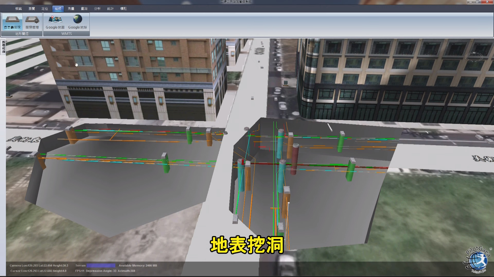
11. Hole Management
The opacity of the terrain can be adjusted. When the terrain is set to opaque, the system can simulate the digging area and display pipelines with its hole management feature.
The system also provides the following advantages:
(1). 3D Building and Pipeline model display
(2). Fast display speed
(3). Able to handle large datasets
(4). Highly Compatible and Supported
(5). Highly Customizable Features