Taoyuan Department of Water Resources 3D GIS Management System
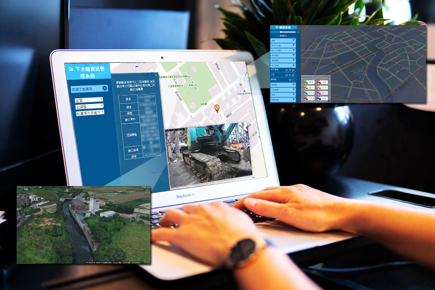
A 3D GIS platform built by Pilotgaea for the Department of Water Resources, Taoyuan. The system integrates information on facilities and water resources including rivers, sewage stations, pipelines, pipeline equipment, etc., to increase efficiency in the management of each facility and assist in planning water-related measures or emergency response measures for disasters for the department.
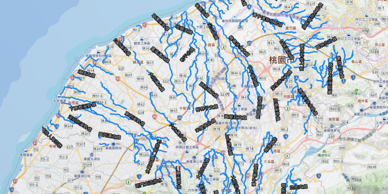
1. The system displays water resources and related data in 3D space to highlight Taiwan's diverse geographical features and enable users to make more suitable decisions based on local water resource distributions:
1. Map data of rivers, ditches, and catchment areas and other water resources.
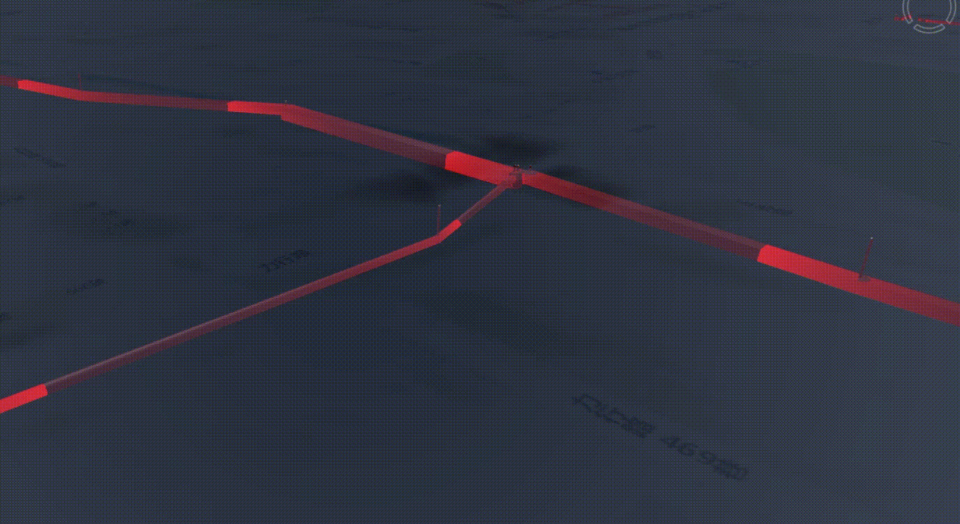
2. 3D Pipelines
3. BIM Models
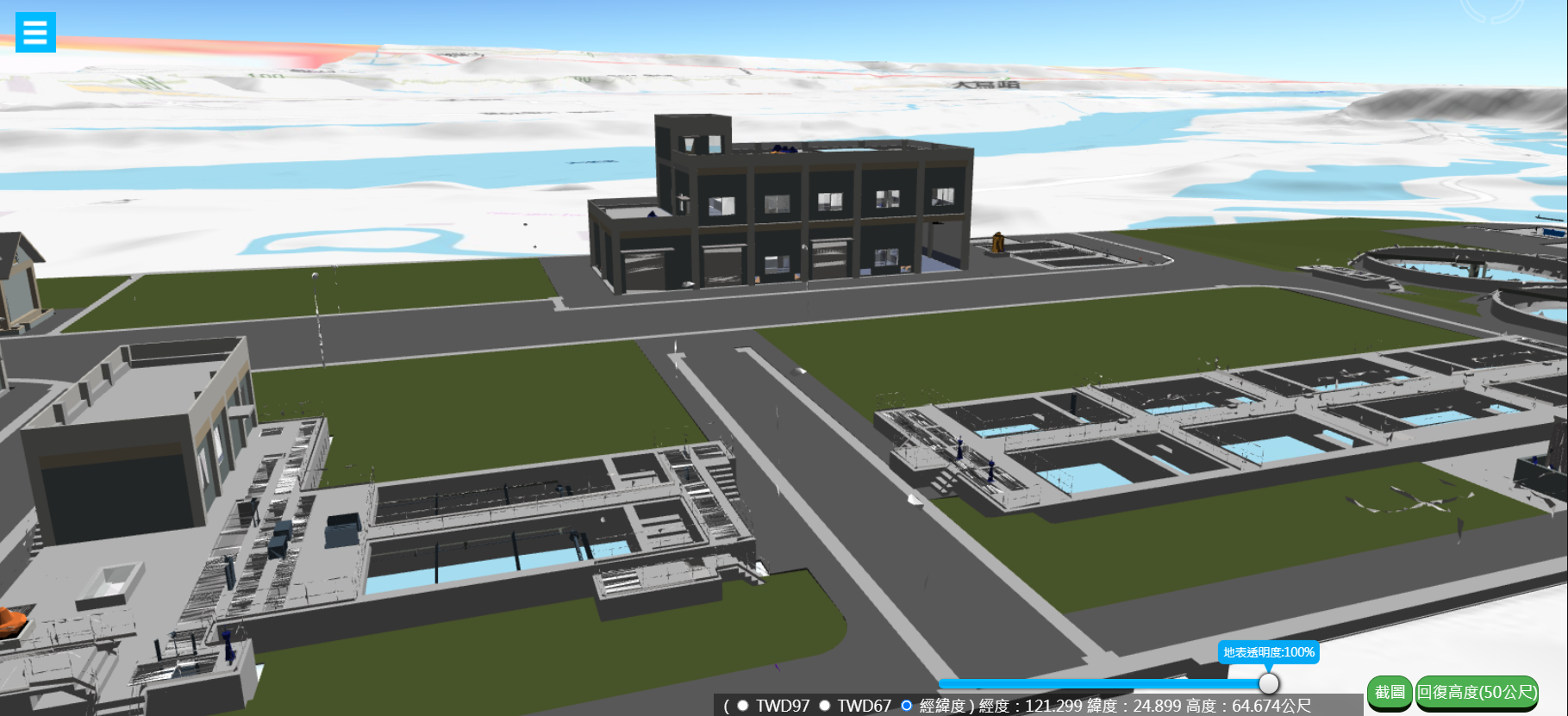
▲ Sewage Station BIM Model
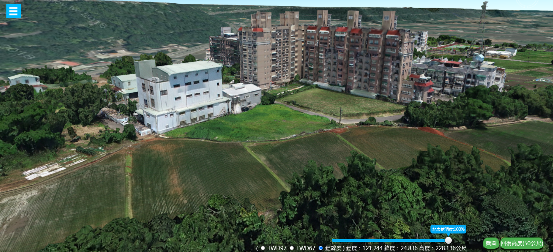
4. UAV Photogrammetry Model
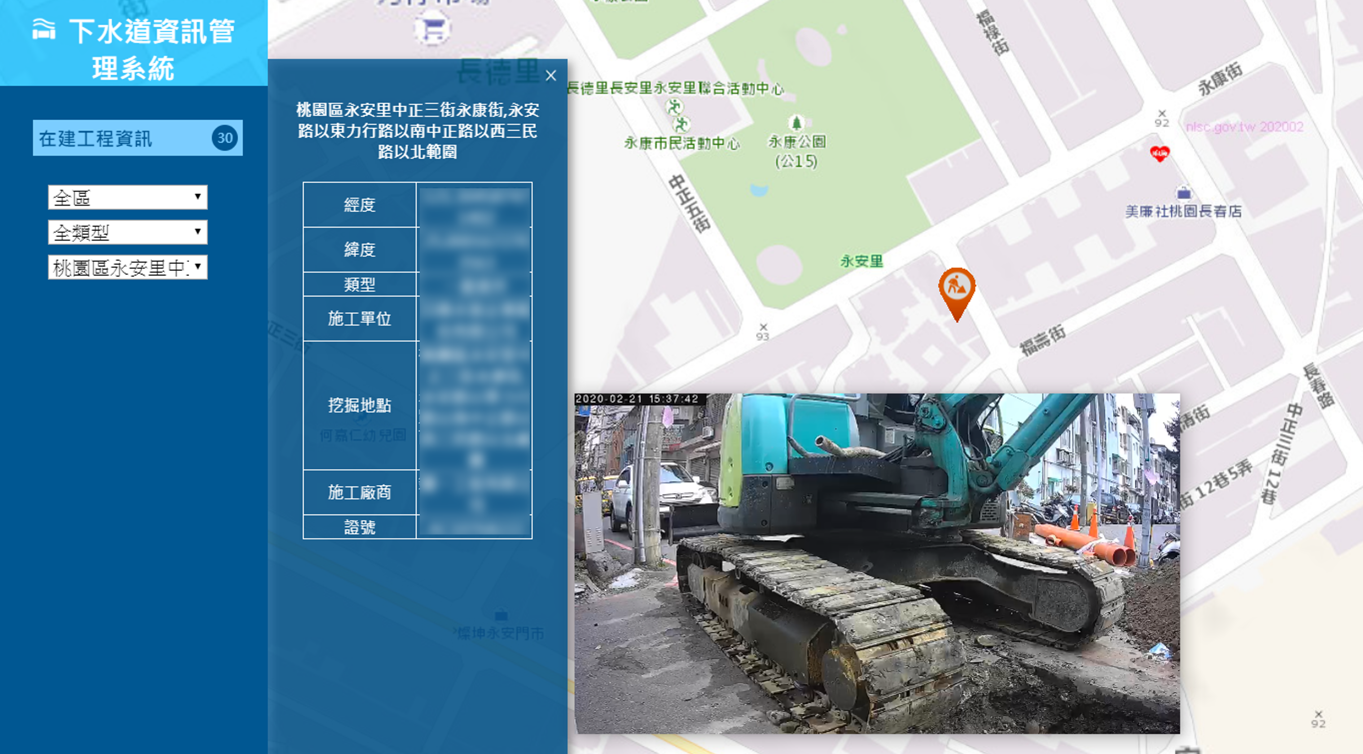
5. Integrating Information from Equipments
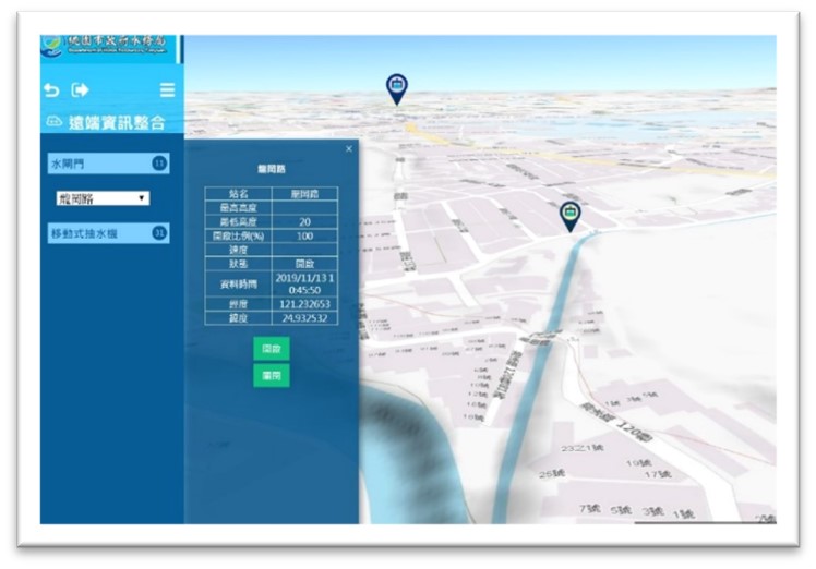
▲Water Gates
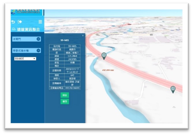
▲Mobile Pump
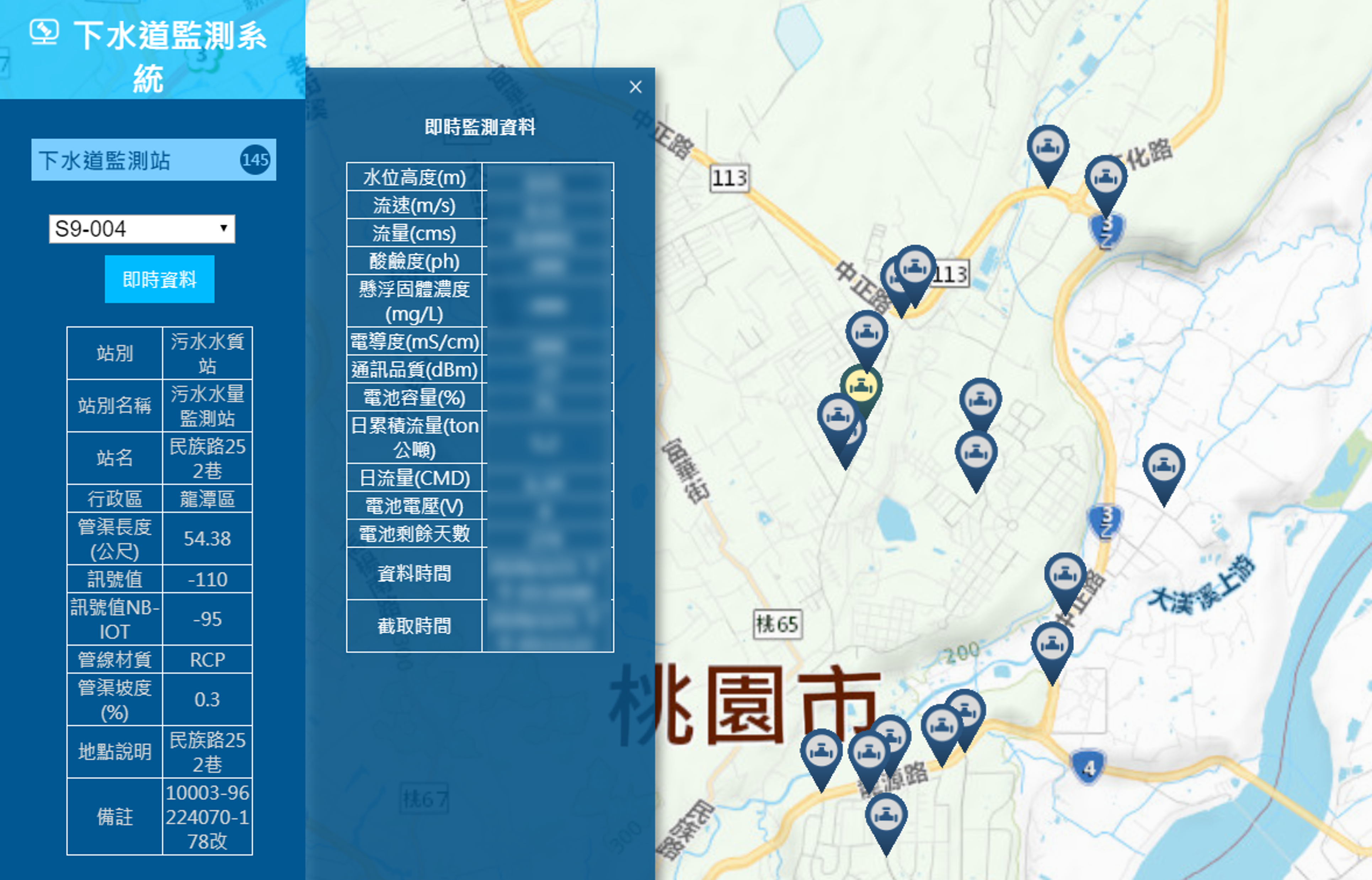
▲Sewer Monitoring Station
7. Disaster Escape Route and Shelters
Intuitive display of shelter locations by overlaying data over of 3D terrain.
.PNG)
2. Features
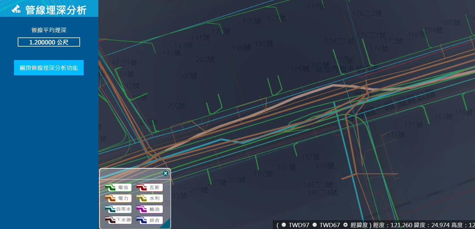
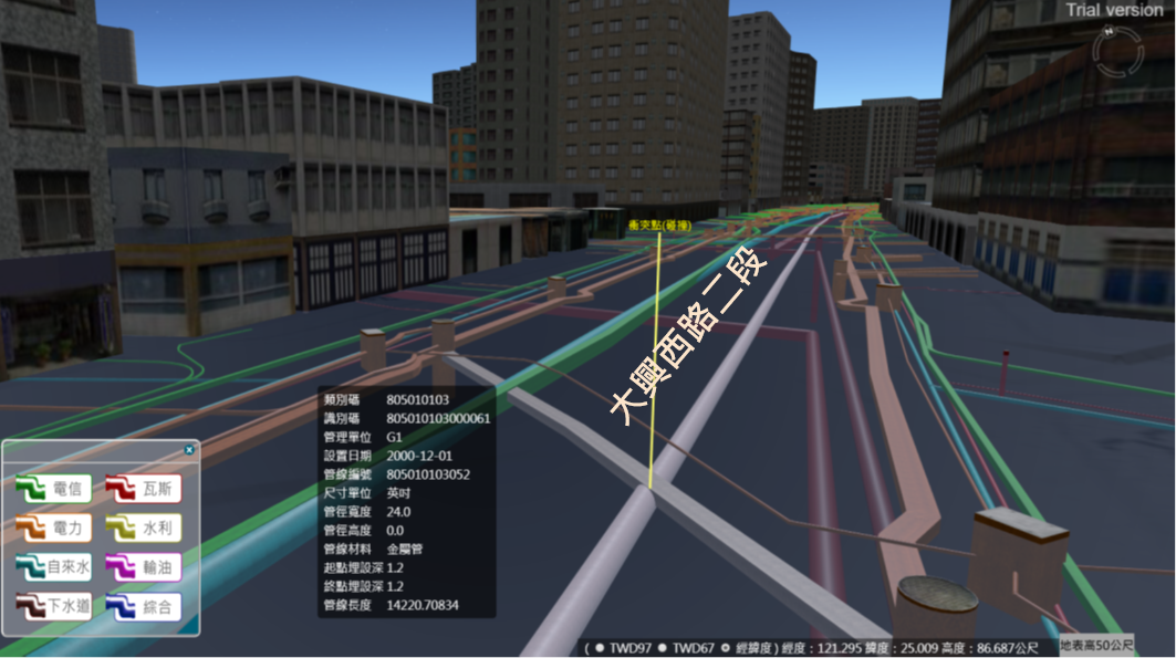
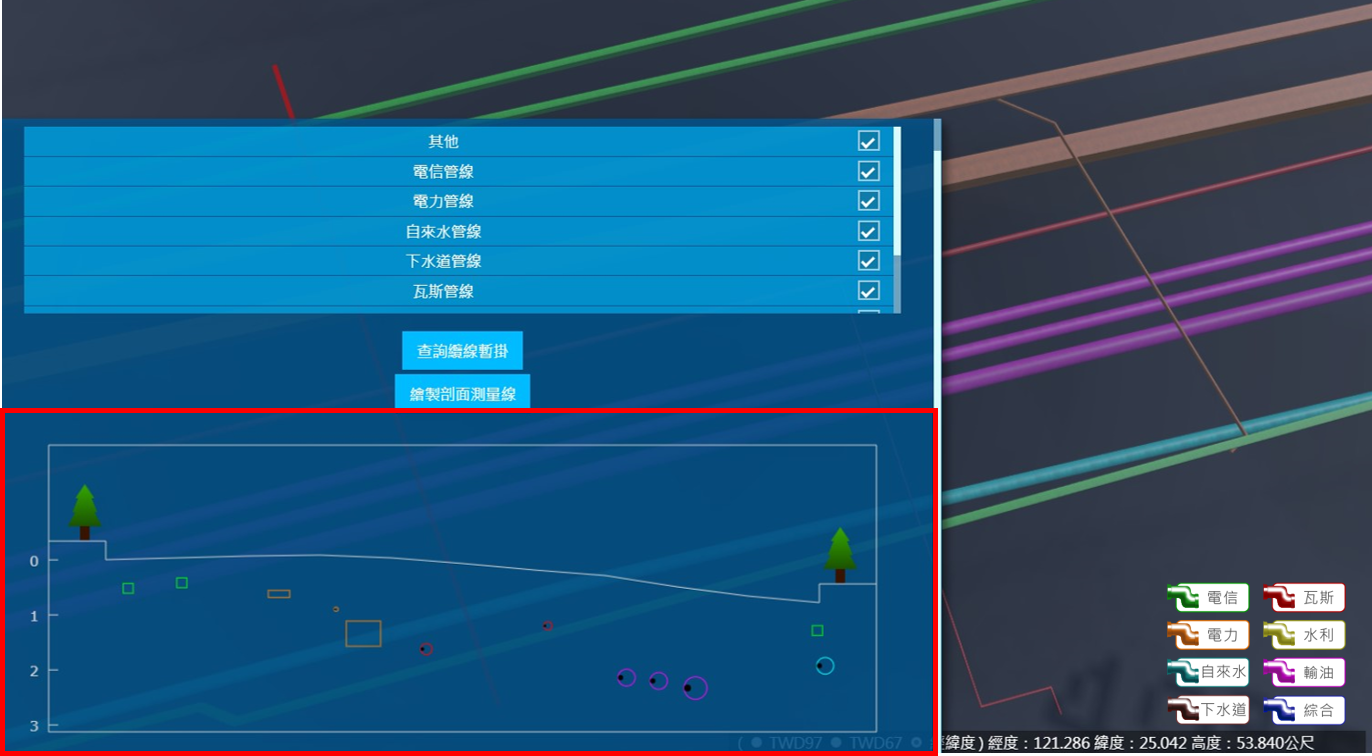
1. Pipeline Analysis
(1) Pipeline Buried Depth Analysis
(2) Conflict Analysis
(3) Section Analysis
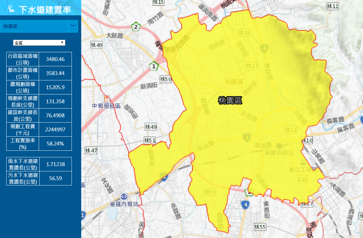
2. Pipeline Statistics
(1) Sewer Build Rate
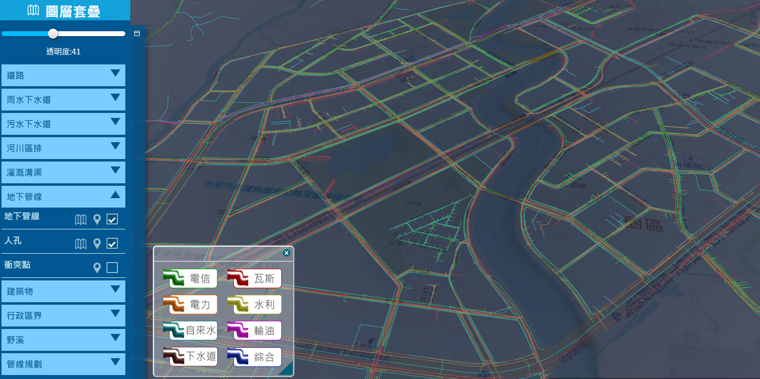
3. Integrated Display
(1) Pipeline Flow Direction
(2) Real-Time Image