Integrated Applications
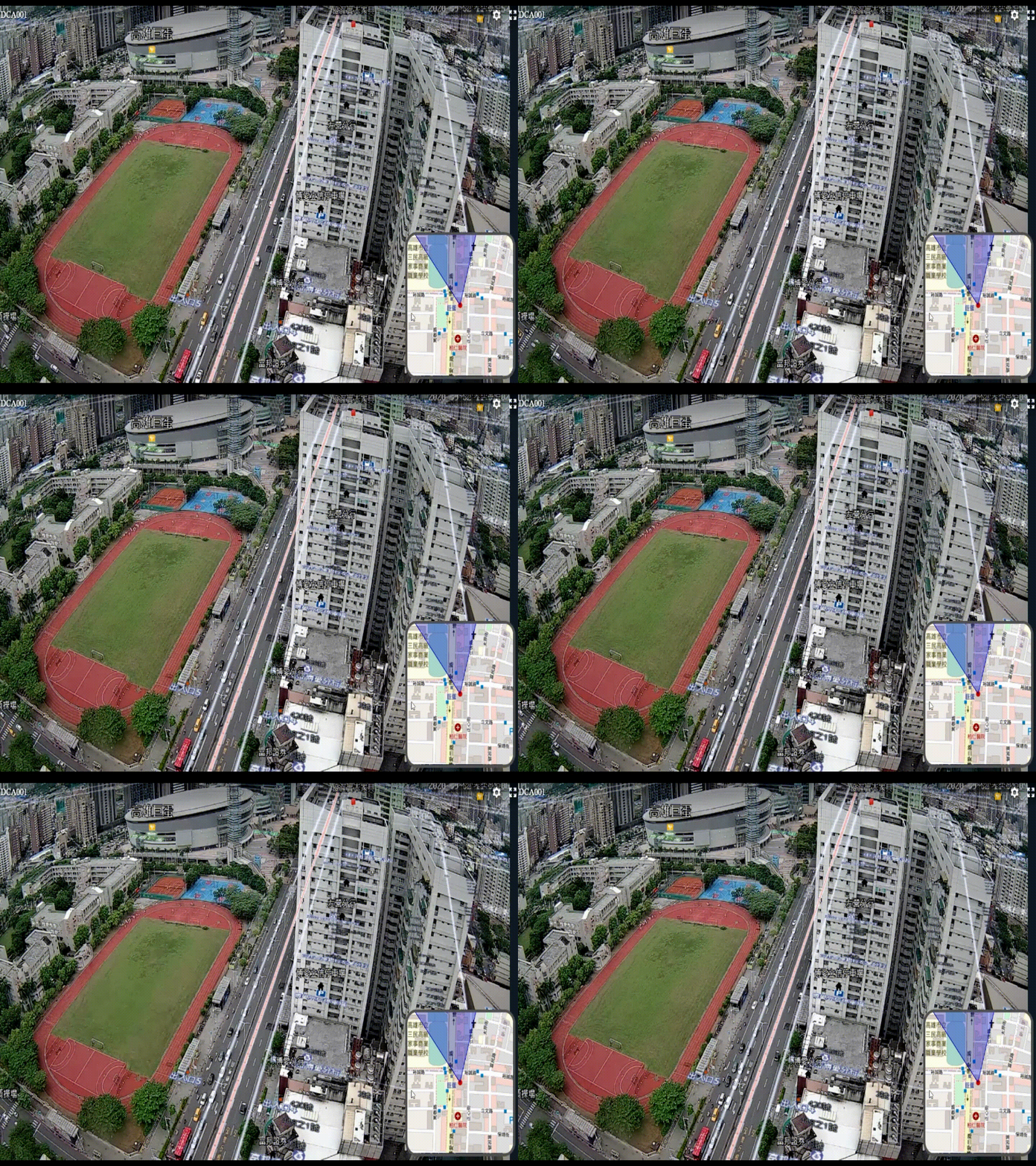
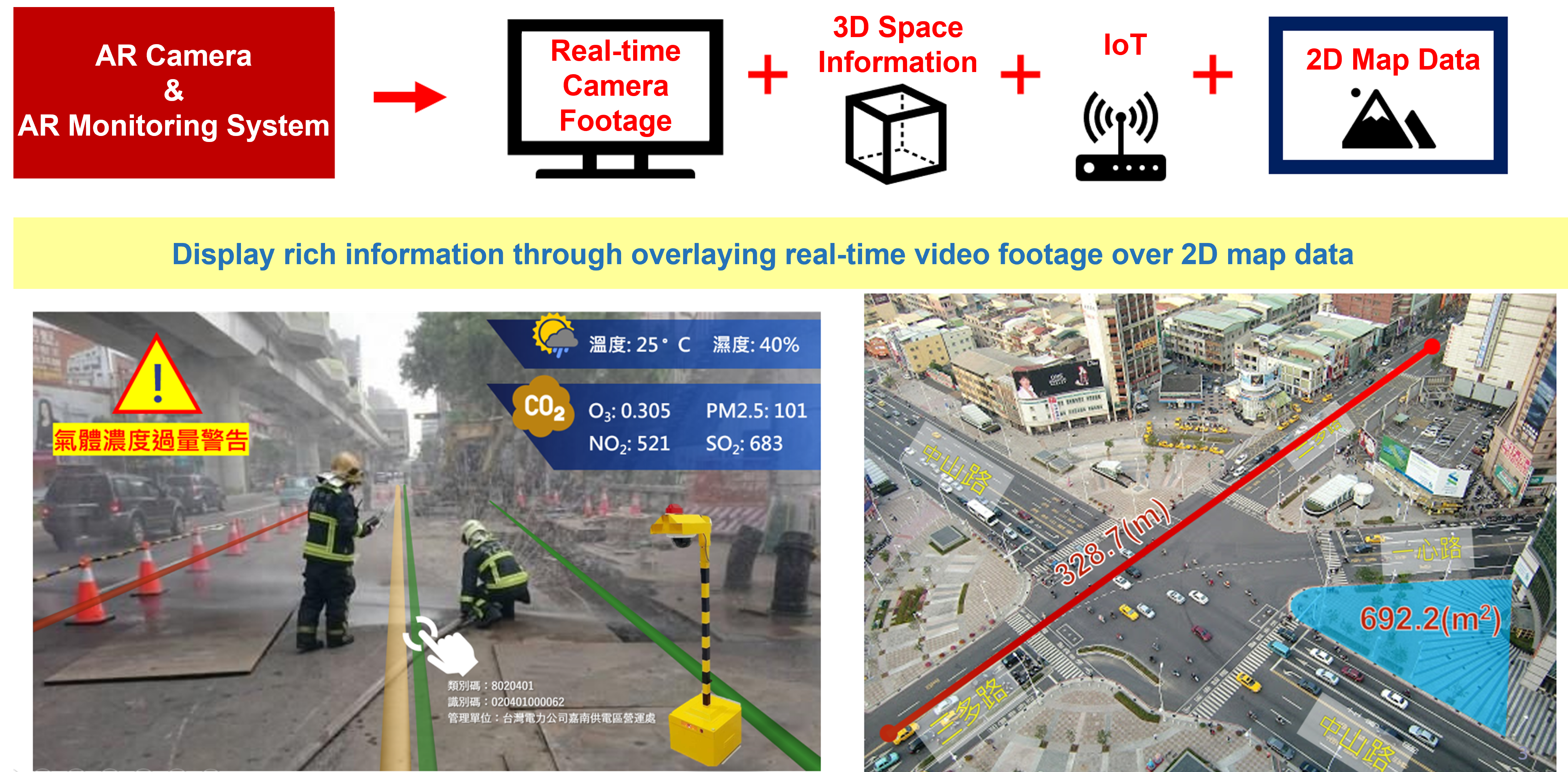
Integrating with 2D road data
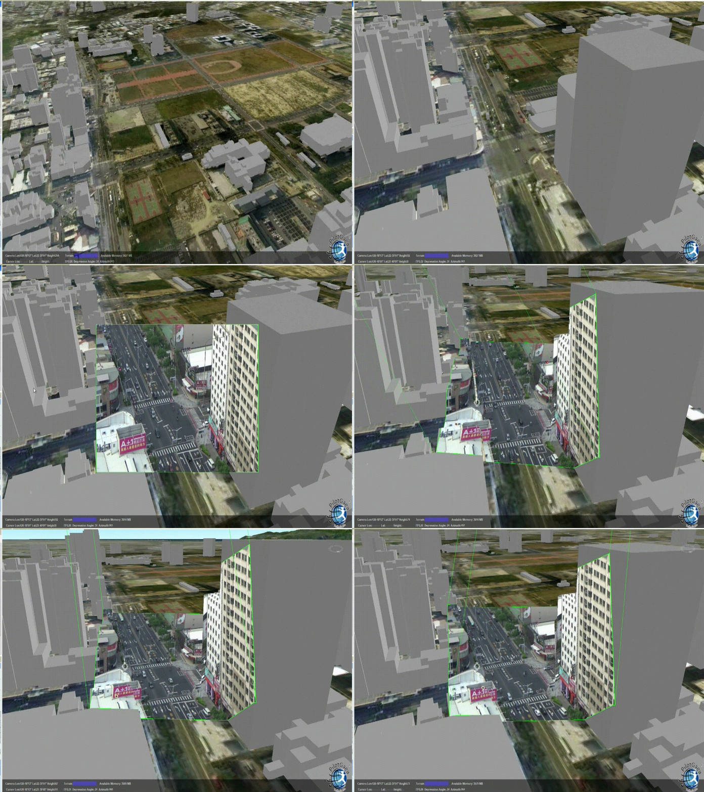
Integrating with 3D model data
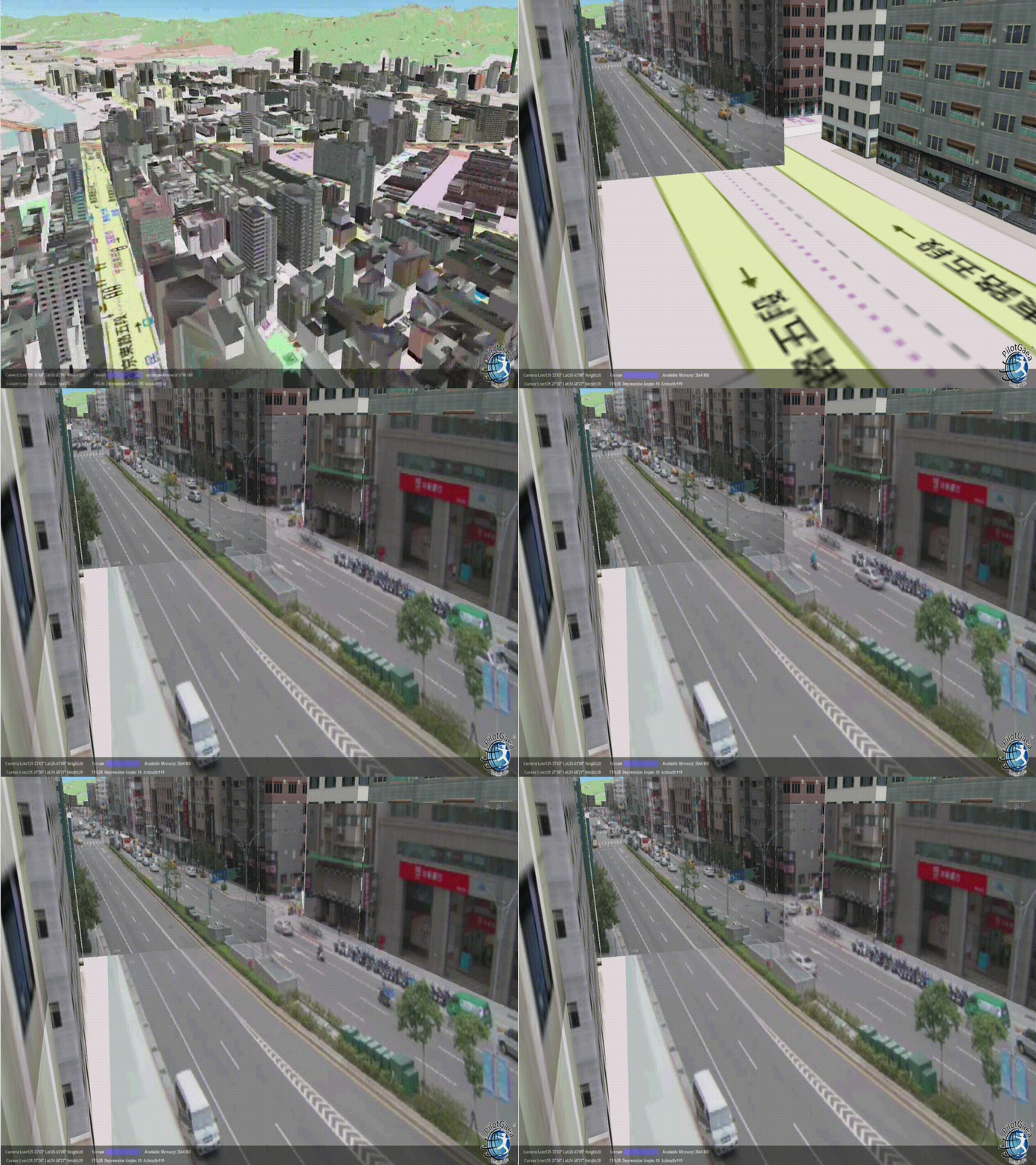
Integrating multiple views with buildings
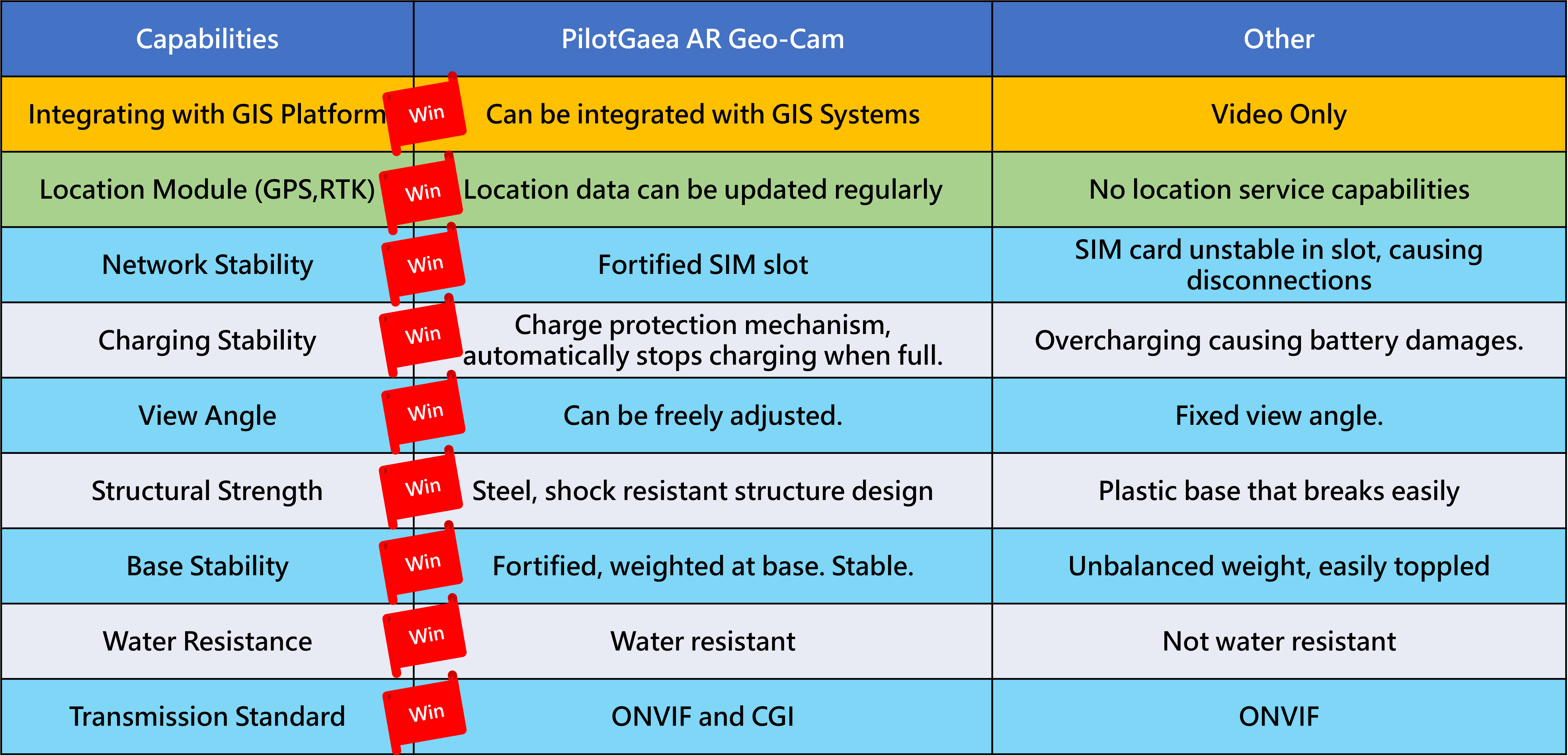
Comparison with other monitoring systems
Scenario
1.Disaster Damage Estimation
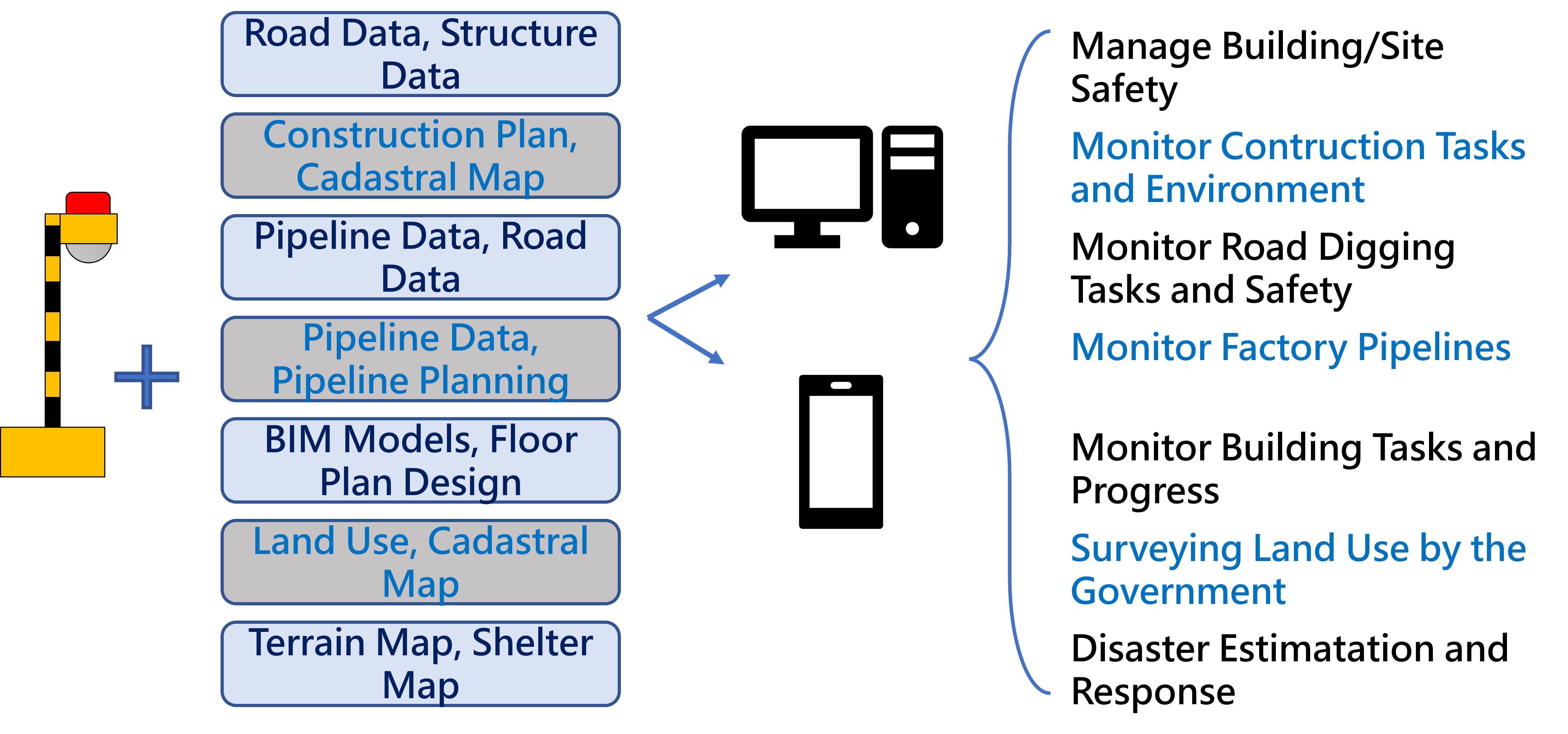
Area damaged by natural disasters such as typhoons, earthquakes, tsunamis and land slides can be estimated by overlaying information of cadastral map or land use map data.
Get real time information, decrease processing time, increase efficiency in disaster response
2.Construction
BIM models can be overlaid on construction site images, giving details on for monitoring construction structure and materials. Construction process can be checked by viewing models of each construction period.
No more cross checking the site and design plans with the naked eye, speeding up communication time and increases the quality of constructions, creating a dynamic management system
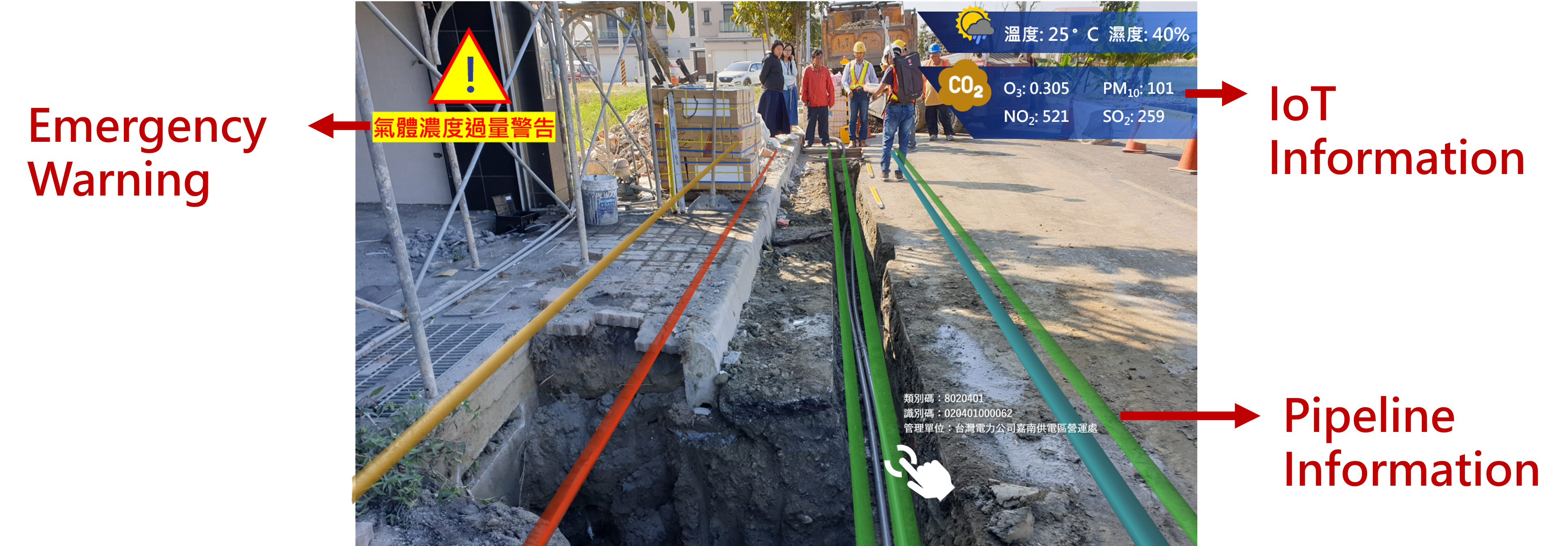
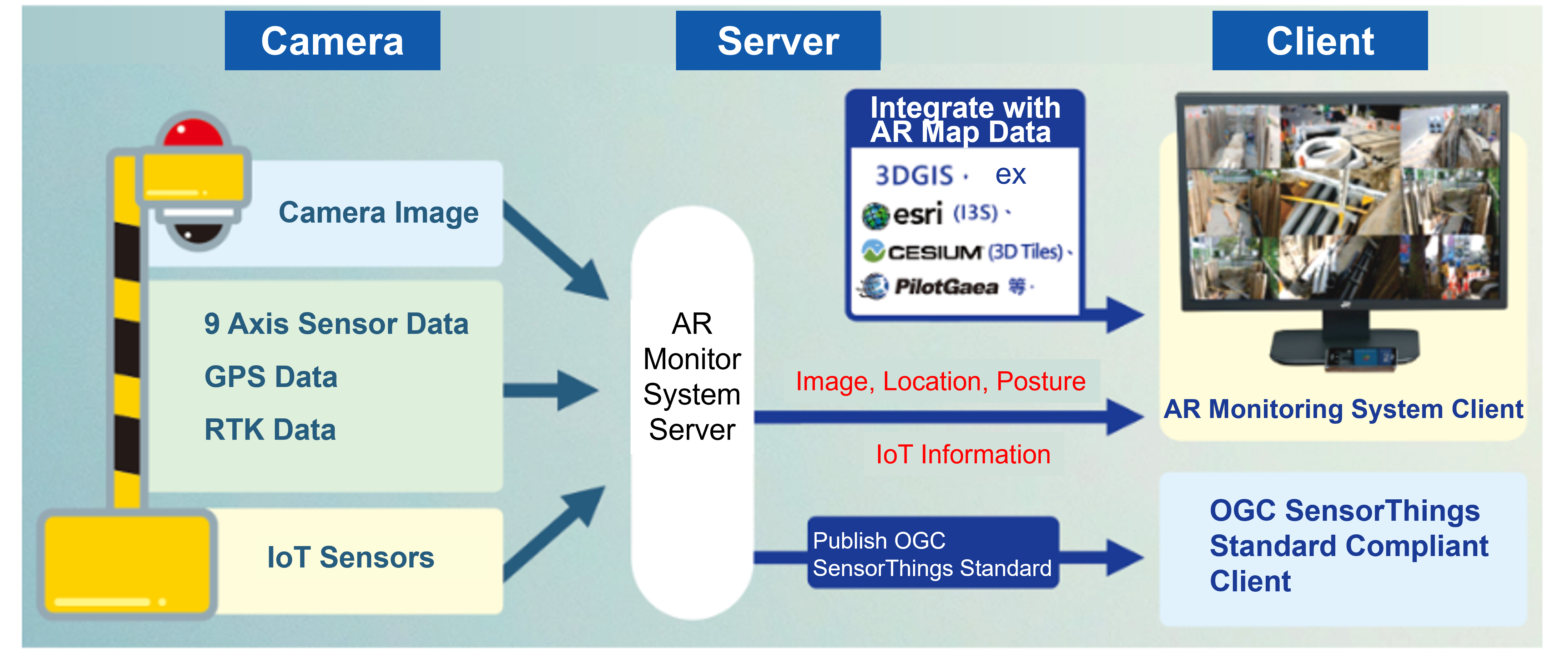
3.Integrating with IoT
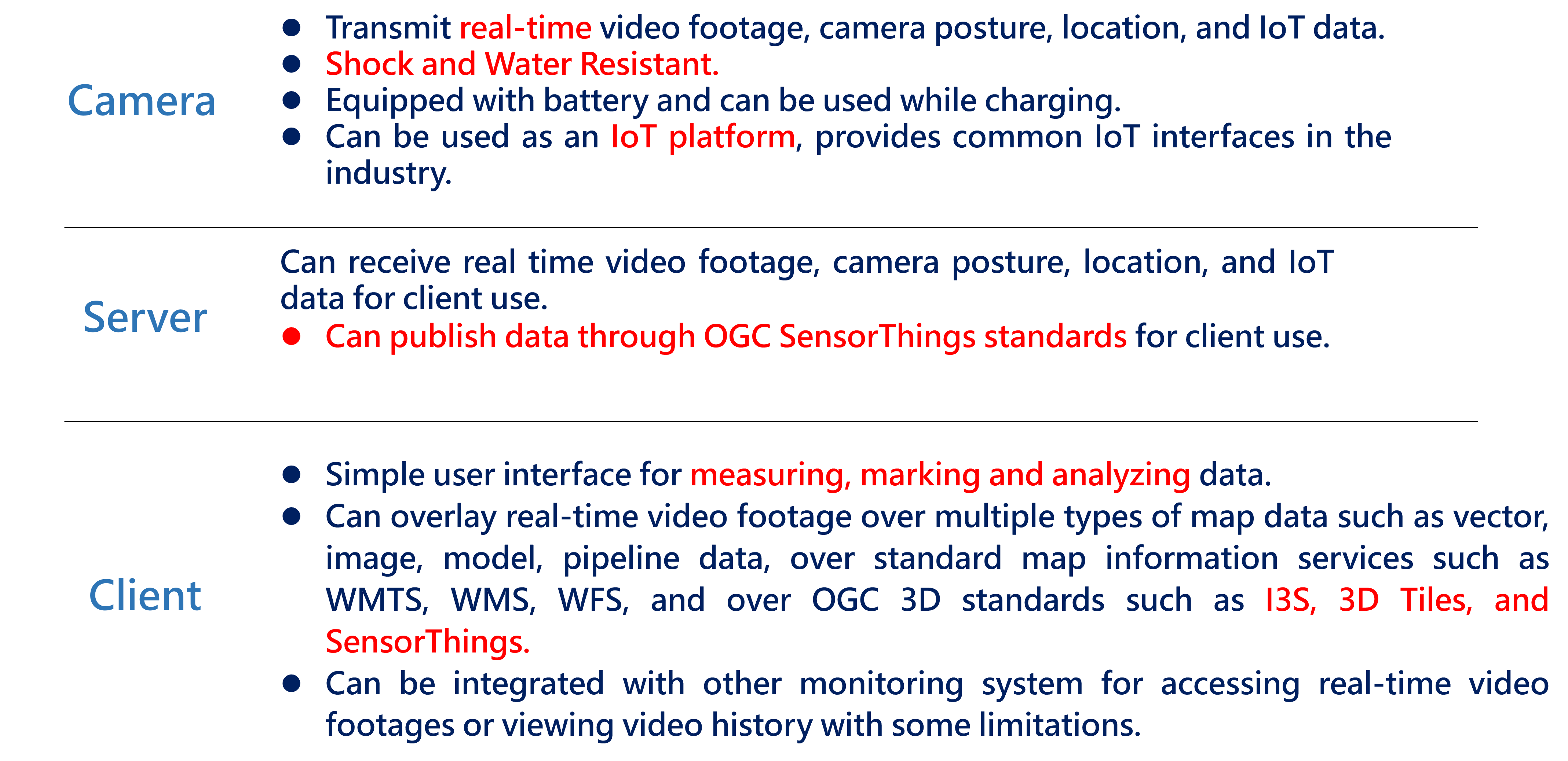
Works immediately during emergency situations
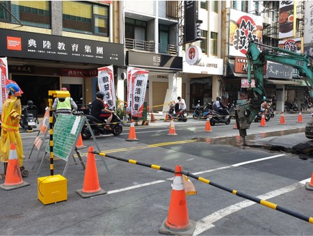
Combined with data of pipeline and contruction plans allows easy access to construction data on site, decreasing the public danger cause by pipeline digging errors, and insures construction quality.
IoT sensors can be connected to detect contaminant such as dust during construction.
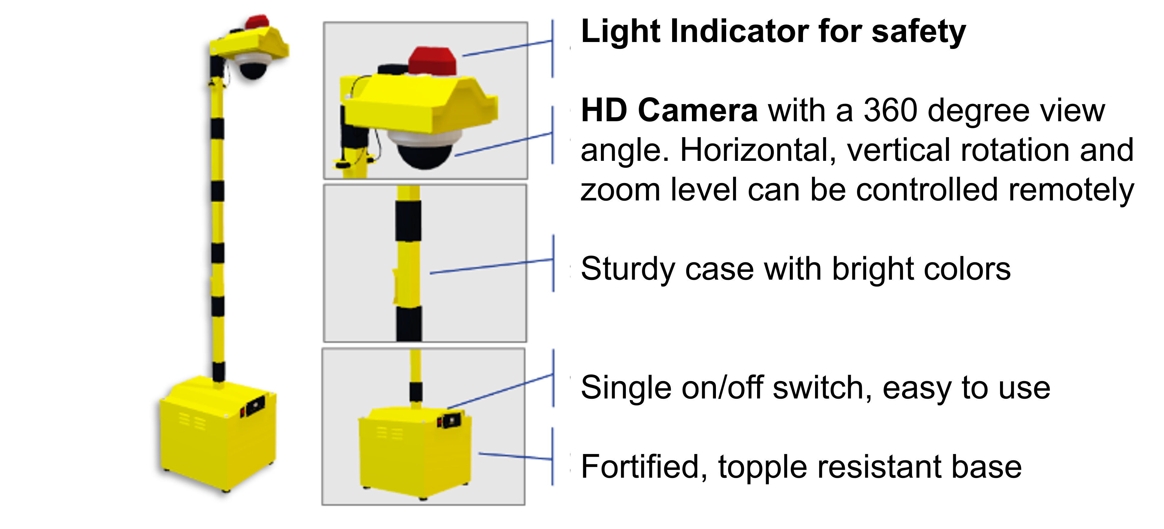
Market Leading Specifications
