The Ministry of the Interior's 3D National Map Service Goes Online
Published
The "Multidimensional National Spatial Information Service Platform" was officially launched today (11). Minister of the Interior Hsu Kuo-yung said that the national base map service provided by the Ministry of the Interior has officially entered 3D, and will promote the integration of diversified land information such as three-dimensional cadastral property rights, BIM (Building Information Model), building registration and transactions, which will bring a smarter and more convenient life for the public.
The Ministry of the Interior (MOI) said that in line with the National Development Council's promotion of the National Geographic Information System (NGIS), the MOI has upgraded the existing 2D national base map to 3D, and is implementing it from three aspects: data production, standard setting, and service platform construction. At present, 4.4 million 3D approximated building models have been completed nationwide.
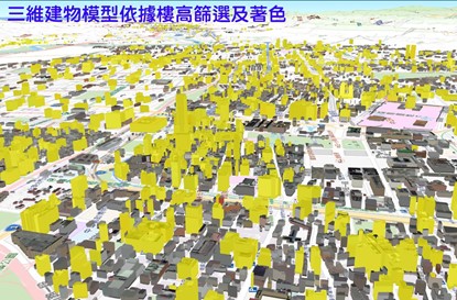
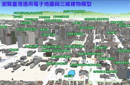
The Ministry of the Interior pointed out that, in order to present the real world's diverse spatial relationships, the implementation strategy of upgrading the existing 2D national base map to 3D mainly adopts a "comprehensive construction first, refine later" strategy. In addition to collecting relevant domestic and foreign literature and implementation results, the Ministry of the Interior continues to collect experience and demand for data refinement through application and demand discussions, and gradually refine the content and services of the 3D national base map to meet the needs of different users. For more information, visit "Multidimensional National Spatial Information Service Platform" online https://3dmaps.nlsc.gov.tw (developed by PilotGaea).