Taichung "3D Pipeline System" Sees Through Ground to Prevent Water Outages and Fires
Published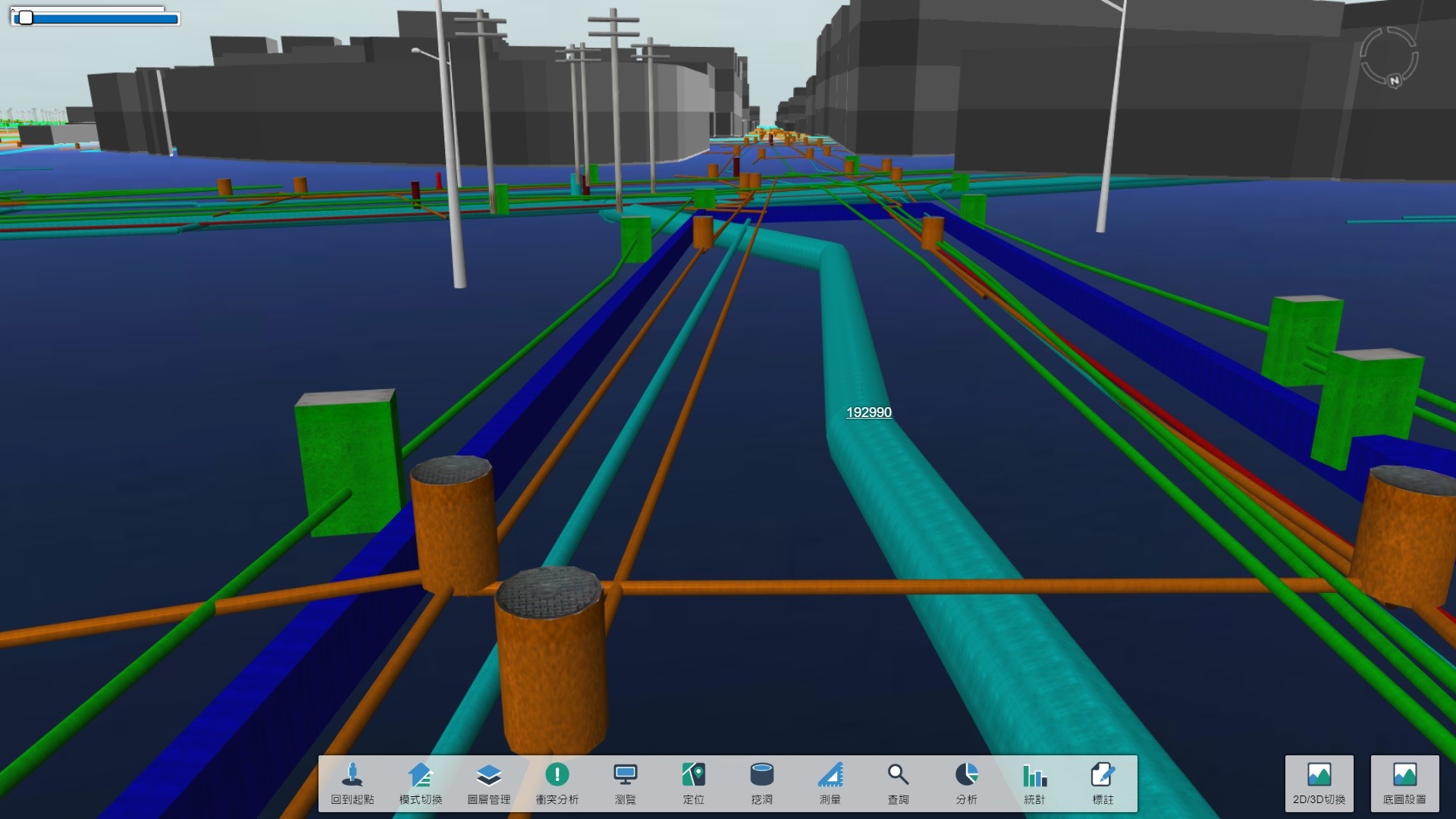
In recent years, Taichung City has repeatedly reported incidents of excavation of water pipes and gas pipes, resulting in major water outages and fire accidents. The city government's Construction Bureau said today (3) that it has introduced 2D/3D GIS technology to integrate the public pipeline database, combining real-time images of on-site excavation with a three-dimensional pipeline system, which has now been built and is open for use by relevant units to improve the quality of work safety.
In recent years, the city has dug through water pipes three times in three months, resulting in 60,000 to 200,000 households without water for as long as 36 hours; there were also three emergency incidents of gas pipe dug through in one month, and the fire was once difficult to control.
In this regard, former Mayor Lin Chia-Lung's team actively promoted "3D GIS technology" to assist in the management of public facility pipeline data. Through the assistance of information technology, 3D pipeline conflict analysis and map data correction are promoted to effectively manage the pipeline construction and maintenance operations corresponding to the road excavation life cycle.
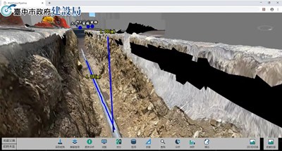
According to the Construction Bureau, the virtual-real integrated 3D pipeline system can provide 3D pipeline realistic display capability for underground public pipelines, and also provide innovative image and data virtual-real integrated technology, using cameras combined with real-time dynamic technology and gyroscope information during road excavation, allowing managers to experience the real world.
In addition, by creating a 3D model of the current conditions of the excavation site, the 3D GIS model measurement function can be further used to check the accuracy of the as-built data such as burial depth and construction area. In case of an accident, the historical image playback function can also be provided to enhance management efficiency and convenience. Construction Director Chen Dada said that the use of the 3D system will allow construction companies to better understand the distribution of underground pipelines before excavation to avoid mis-excavation. The system also allows pipeline units to use conflict analysis to speed up the correction of pipeline maps, and with real-time image monitoring, it greatly improves the quality of work safety and protects the safety of the surrounding public.
Source: https://news.ltn.com.tw/news/Taichung/breakingnews/2935265 <br>