Tainan 3D Pipeline Data Set Up
Published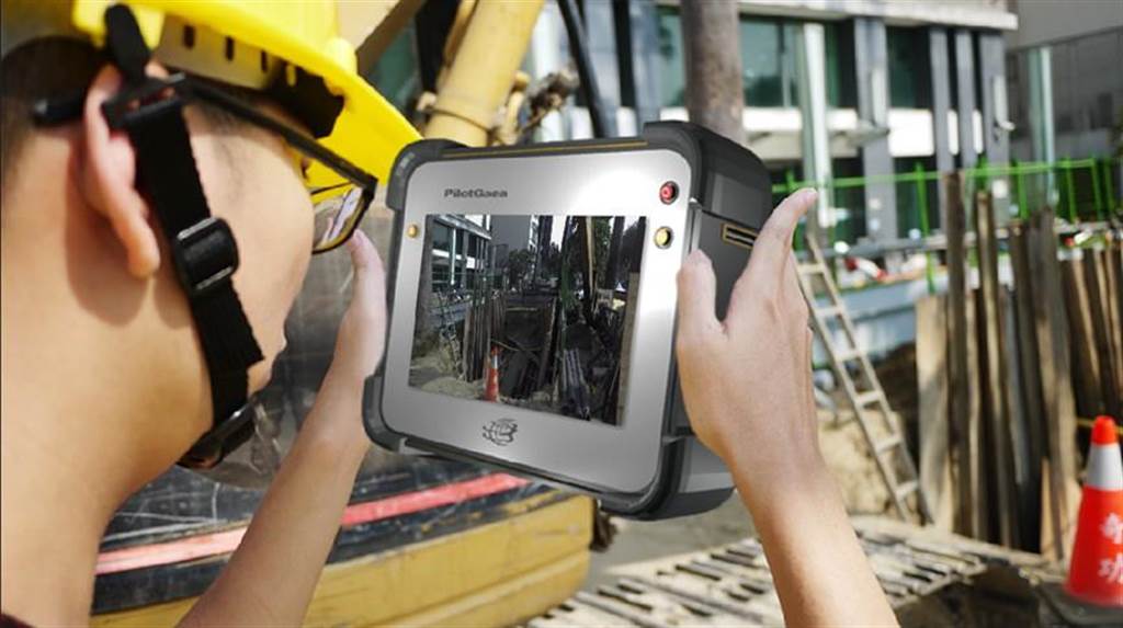
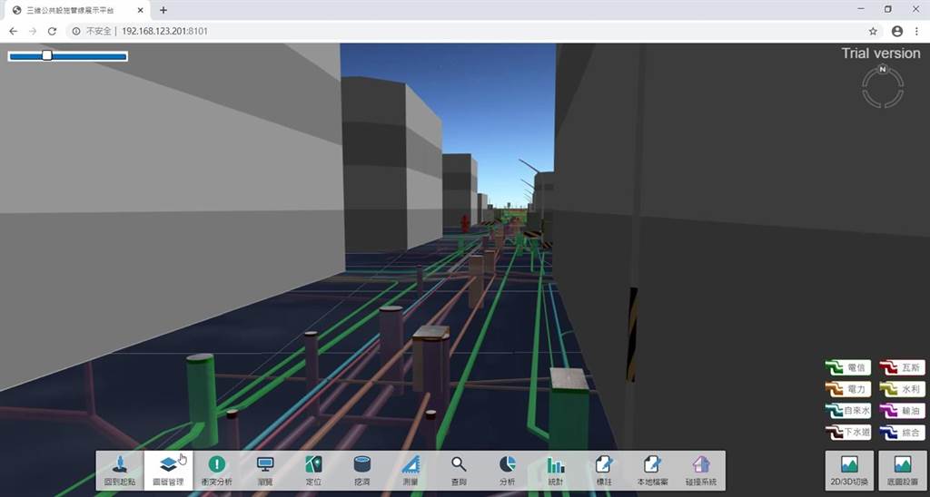
A serious road collapse at a residential construction site in New Taipei City has led to a renewed discussion on underground pipelines. In view of the fact that buried pipelines are like "invisible crises", the Tainan City Works Bureau established the "Greater Tainan Road Excavation Management Center" on June 30, 2015, and started to build three-dimensional pipeline mapping information in FY107, and has now completed the establishment and application of three-dimensional pipeline mapping information in the city.
Tainan Mayor Wei-chieh Huang asked the relevant units to strengthen the review of the current pipeline management facilities and mechanisms to protect the lives and property of the public. The Bureau of Public Works said that after the establishment of the Greater Tainan Road Excavation Management Center, the road surface requires a three-year ban on new pavement excavation, and various underground pipelines were also completed in the first phase of the city's 8-meter road pipeline map information in 2017. Road excavation repair road surface can only have color difference but not height difference, each piece of road excavation to complete the takeover and require the pipeline unit independent quality control, etc., and combined with the political wind and inspection units to set up sampling inspection team to strengthen the sampling inspection of the quality of road repair, to prevent jerry-building and other shortcomings<br>
In addition, we have upgraded the 3D pipeline mapping information since FY107, and we have completed the expansion of the AR external inspection system in that year. In FY108, the 3D camera and pipeline excavation image system were completed, and this year, the 3D technology was used to correct the data of pipeline excavation.
The Bureau of Public Works emphasizes that the 3D camera can retain images of the construction site, which can be accessed for future review and even further depth and distance calculation, solving the current problem of not being able to perfectly preserve the construction site. At present, the 3D technology is also used to correct the existing pipeline data. By combining the existing data on the road excavation system of Tainan City with the 3D technology, the old pipeline drawings can be checked and corrected to provide the excavation unit with more accurate drawings to avoid mis-digging.
In order to improve the management of road excavation in Tainan, the Public Works Bureau will further refer to advanced countries to strengthen the integration of environmental and disaster management, infrastructure, homeland security and community services related to coordination and governance and operation to ensure public safety.
Source:https://www.chinatimes.com/realtimenews/20200717004645-260421?chdtv