New Highlight in Taiwan's Port Management: 3D Smart Map Platform Coming Online
Published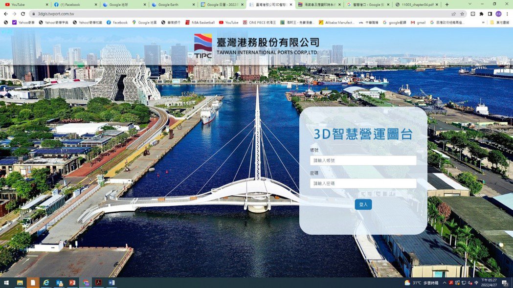
New highlight of Taiwan port's intelligent management: 3D intelligent operation charting platform will be launched<br><br>Taiwan Port Corporation will soon launch the "3D Intelligent Operation Platform", which will fully utilize the technologies related to the establishment of 3D building models, artificial intelligence (AI) image recognition and IOT sensors in the port area to integrate public pipeline maps, water depth data, building model maps and sea weather information in the port area, and present them in a visual way, which will not only enable real-time management of the port, but also strengthen the emergency response efficiency of the port and effectively The system not only enables real-time port management, but also enhances port emergency response and effectively improves safety and environmental management in the port area.<br><br>Taiwan Port Corporation pointed out that the system especially introduces the latest aerial modeling technology in Taiwan and develops 3D image modeling system, using new unmanned aerial vehicles such as Marlyn, Parrot ANAFI USA, Industrial MK2, etc., equipped with high-precision tilt camera and RTK real-time positioning, to take pictures of the whole area and building models, including seven major international commercial ports and Penghu and Puchu. The total land area of the port area is 6,098.2 hectares, and the port buildings, pier structures, breakwaters, bridges, bridges, gates, and other important structures can be modeled in 3D with centimeter-level accuracy to highly restore the real situation, allowing managers to make real-time management and judgment through programs and subsequent import of attribute data such as underground pipelines, assets, sea weather, bathymetry, and cadastral information.<br><br>After the completion of 3D land modeling, the 3D pipeline data platform, 3D harbor bathymetry data platform, and 3D ground equipment and building model management system are incorporated into the system to provide 3D base map services, so that future harbor system development can have a public version of the illustration to use, with a view to creating a safe and efficient platform, and a marine meteorological information platform, and other four modules to use, and integrate 3D pipeline mapping, bathymetry, asset geographic information, and real-time cadastral information in the harbor. The system will be used as an important internal system of the port and will lay the foundation for the development and application of the smart port. In the future, the on-site management, graphic query, data integration and operational efficiency can be greatly improved.<br><br>After the development of this system, the subsequent expansion of the application includes the ability to connect the 3D illustration results to the port asset management system, the warfare platform, the business intelligence platform, and the energy management rate and environmental protection smart port through the network.